Image:Gelre1477.png
From Wikipedia, the free encyclopedia
No higher resolution available.
Gelre1477.png (334 × 277 pixels, file size: 183 KB, MIME type: image/png)
| | This is a file from the Wikimedia Commons. The description on its description page there is shown below.
|
[edit] Description
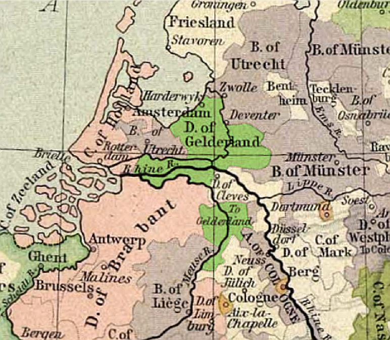
![]() : Carte du duché de Gueldre, en 1477
: Carte du duché de Gueldre, en 1477
![]() : Map of duchy of Guelders, in 1477
: Map of duchy of Guelders, in 1477
- uploadé sur Wikipédia NL par User:Känsterle le 17 décembre 2005.
- Highlighting of Guelders: User:Eugene van der Pijll.
| This map come from the map collection of University of Texas and more exactly from this one : Central Europ in 1477, from Historical Atlas by William R. Shepherd, 1926.. It is in public domain (http://www.lib.utexas.edu/maps/faq.html#3.html). | |
| Cette carte est issue issu de la collection de cartes de l'université du Texas et plus précisément de celle-ci : Central Europ in 1477, from Historical Atlas by William R. Shepherd, 1926.. Elle se trouve dans dans le domaine public (http://www.lib.utexas.edu/maps/faq.html#3.html). | |
| Deze afbeelding is afkomstig uit de kaartencollectie van de University of Texas. Deze kaarten bevinden zich in het publiek domein (http://www.lib.utexas.edu/maps/faq.html#3.html). |
[edit] Licensing
| This work is in the public domain in the United States, and those countries with a copyright term of life of the author plus 70 years or less. |
File history
Click on a date/time to view the file as it appeared at that time.
| Date/Time | Dimensions | User | Comment | |
|---|---|---|---|---|
| current | 19:02, 25 February 2006 | 334×277 (183 KB) | Eugene van der Pijll | |
| 18:20, 25 February 2006 | 334×277 (165 KB) | Odejea | (== Description == Carte du duché de Gueldre, en 1477 Origine : * collection de cartes de l'Université du Texas (http://www.lib.utexas.edu/maps/). Ces cartes sont dans le domaine public (http://www.lib.utexas.edu/maps/faq.html#3.html). * uploadé sur W) |
File links
The following pages on the English Wikipedia link to this file (pages on other projects are not listed):

