Image:FWA airport map.PNG
From Wikipedia, the free encyclopedia
Size of this preview: 387 × 600 pixels
Full resolution (731 × 1,133 pixels, file size: 101 KB, MIME type: image/png)
| | This is a file from the Wikimedia Commons. The description on its description page there is shown below.
|
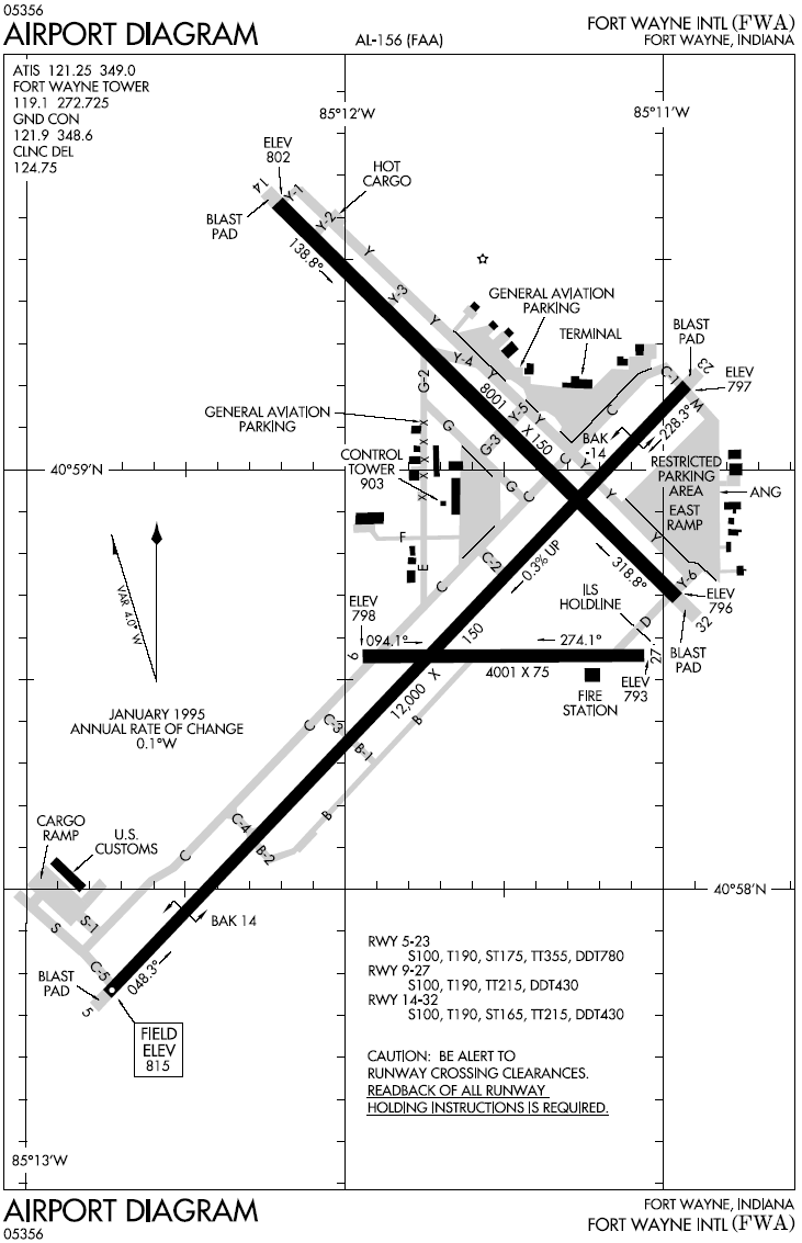
Airport map for Fort Wayne International Airport
| This image is a work of a Federal Aviation Administration employee, taken or made during the course of an employee's official duties. As works of the U.S. federal government, all FAA images are in the public domain. |  |
File history
Click on a date/time to view the file as it appeared at that time.
| Date/Time | Dimensions | User | Comment | |
|---|---|---|---|---|
| current | 17:43, 5 January 2006 | 731×1,133 (101 KB) | Cmprince | (Airport map for Fort Wayne International Airport {{PD-USGov-FAA}}) |
File links
The following pages on the English Wikipedia link to this file (pages on other projects are not listed):

