Image:FrancoPrussianWar5to6Aug1870.jpg
From Wikipedia, the free encyclopedia
Size of this preview: 700 × 600 pixels
Full resolution (1,083 × 928 pixels, file size: 1.04 MB, MIME type: image/jpeg)
| | This is a file from the Wikimedia Commons. The description on its description page there is shown below.
|
File history
Click on a date/time to view the file as it appeared at that time.
| Date/Time | Dimensions | User | Comment | |
|---|---|---|---|---|
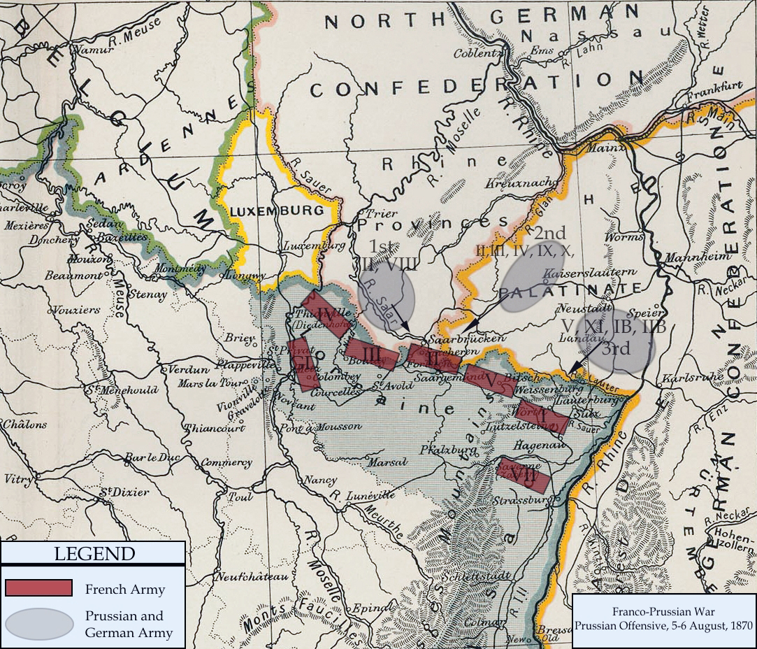
| current | 20:57, 3 January 2008 | 1,083×928 (1.04 MB) | Monsieurdl | (== Summary == {{Information |Description=Franco-Prussian War map of 1870 |Source=Cambridge Modern History Atlas |Date=1912 |Author=Edited by A.W.Ward, G.W.Prothero, and Stanley Leathes }} I adapted the map to reflect the state of French and Prussian/Germ) |
File links
The following pages on the English Wikipedia link to this file (pages on other projects are not listed):
Metadata
This file contains additional information, probably added from the digital camera or scanner used to create or digitize it. If the file has been modified from its original state, some details may not fully reflect the modified file.
| Orientation | Normal |
|---|---|
| Horizontal resolution | 200 dpi |
| Vertical resolution | 200 dpi |
| Software used | Adobe Photoshop CS Windows |
| File change date and time | 15:38, 3 January 2008 |
| Color space | 65535 |

