Image:Flags of convenience.png
From Wikipedia, the free encyclopedia
Size of this preview: 800 × 406 pixels
Full resolution (4,000 × 2,029 pixels, file size: 623 KB, MIME type: image/png)
| | This is a file from the Wikimedia Commons. The description on its description page there is shown below.
|
| Description |
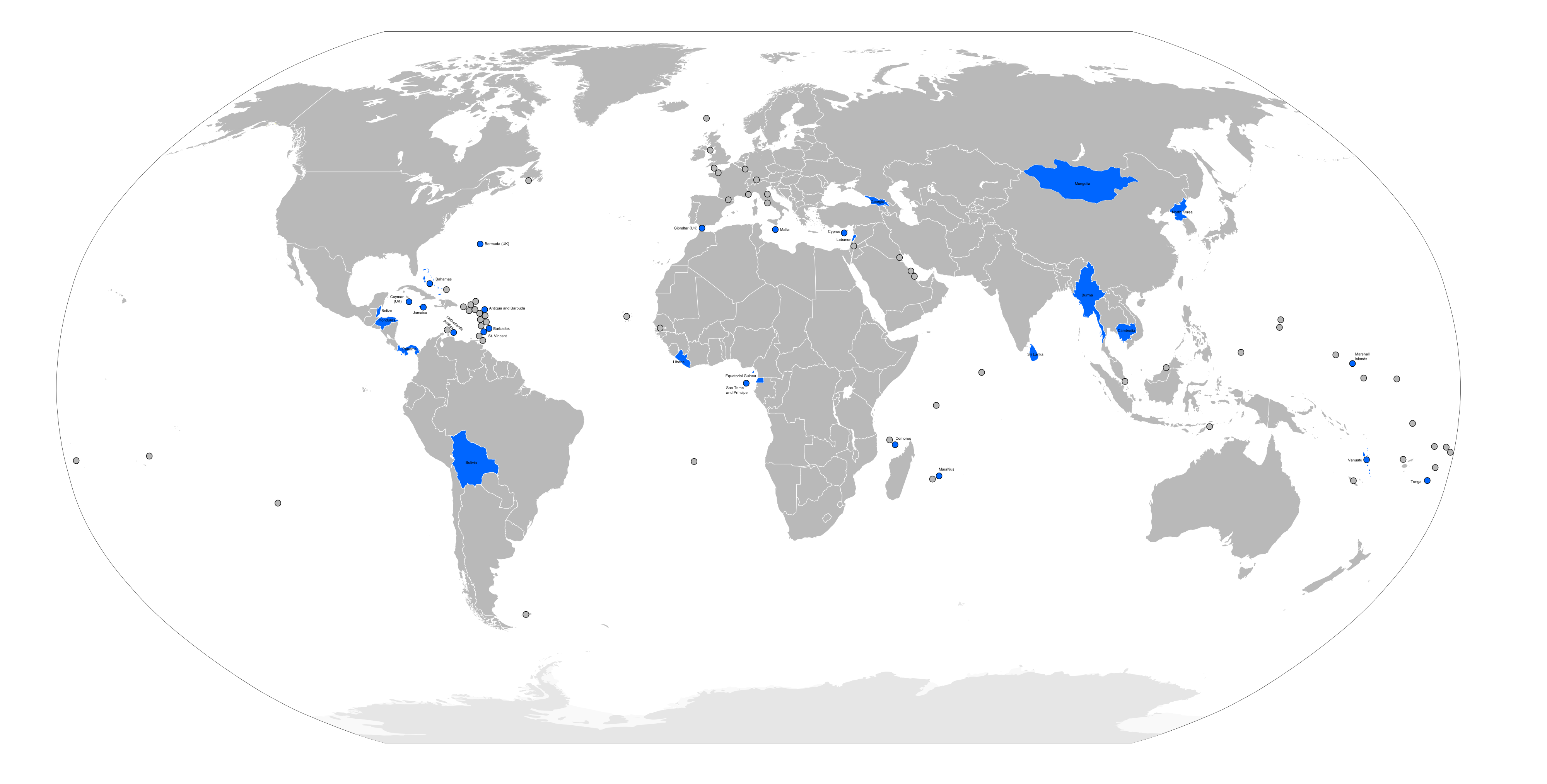
Flags of convenience countries and territories (marked in blue), as listed by the w:International Transport Workers' Federation on [1] |
|---|---|
| Source |
self-made from Image:BlankMap-World6.svg |
| Date |
24 May 2007 |
| Author |
self |
| Permission (Reusing this image) |
see below |

File history
Click on a date/time to view the file as it appeared at that time.
| Date/Time | Dimensions | User | Comment | |
|---|---|---|---|---|
| current | 02:29, 2 April 2008 | 4,000×2,029 (623 KB) | Hoshie | (fixed map. Aruba is not part of the Neth. Anilles; the Marshall Islands are a independent country like Germany, France, Britain, etc.) |
| 22:15, 25 June 2007 | 4,000×2,029 (738 KB) | Roke | ||
| 09:32, 24 May 2007 | 4,000×2,029 (921 KB) | Roke | ({{Information |Description= Flags of convenience countries and territories, as listed by the w:International Transport Workers' Federation on [http://www.itfglobal.org/flags-convenience/flags-convenien-183.cfm] |Source=self-made from [[:Image:BlankMa) |
File links
The following pages on the English Wikipedia link to this file (pages on other projects are not listed):

