Image:Firthofclydemap.png
From Wikipedia, the free encyclopedia
Size of this preview: 531 × 600 pixels
Full resolution (541 × 611 pixels, file size: 18 KB, MIME type: image/png)
| | This is a file from the Wikimedia Commons. The description on its description page there is shown below.
|
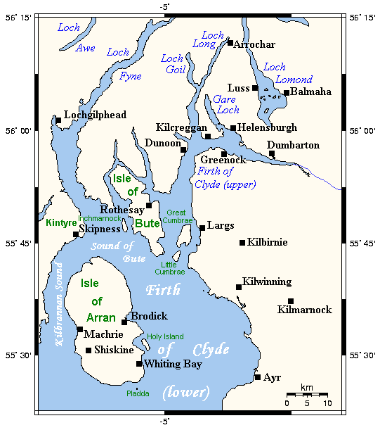
Map of the Firth of Clyde and surrounding lands and waters on the western coast of Scotland.
This map's source is here, with the uploader's modifications, and the GMT homepage says that the tools are released under the GNU General Public License.

File history
Click on a date/time to view the file as it appeared at that time.
| Date/Time | Dimensions | User | Comment | |
|---|---|---|---|---|
| current | 09:59, 29 September 2006 | 541×611 (18 KB) | Voyager | (Map of the Firth of Clyde and surrounding lands and waters on the western coast of Scotland. This map's source is [http://www.aquarius.geomar.de/omc/make_map.html here], with the uploader's modifications, and the [http://gmt.soest.hawaii.edu/ GMT homepag) |
File links
The following pages on the English Wikipedia link to this file (pages on other projects are not listed):

