Image:Fernelmont Namur Belgium Map.png
From Wikipedia, the free encyclopedia
No higher resolution available.
Fernelmont_Namur_Belgium_Map.png (230 × 275 pixels, file size: 4 KB, MIME type: image/png)
| | This is a file from the Wikimedia Commons. The description on its description page there is shown below.
|
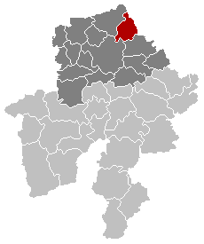
Maps, municipality belgium Fernelmont
| This image has been released into the public domain by its author, LennartBolks. This applies worldwide. In some countries this may not be legally possible; if so: العربية | Български | Deutsch | Ελληνικά | English | Español | Français | Italiano | 日本語 | 한국어 | Polski | Русский | Српски / Srpski | Svenska | தமிழ் | Українська | 中文(繁體) | 中文(简体) +/- |
FR; Carte indiquant la localisation de la commune de Fernelmont dans la Province de Namur.
EN; Map from w:nl:Gebruiker:LennartBolks/kaartenhoekje in Public Domain by the Author choice.
File history
Click on a date/time to view the file as it appeared at that time.
| Date/Time | Dimensions | User | Comment | |
|---|---|---|---|---|
| current | 07:27, 3 March 2006 | 230×275 (4 KB) | Stianbh | (Reverted to earlier revision) |
| 07:25, 3 March 2006 | 230×275 (6 KB) | Stianbh | ||
| 16:55, 27 November 2005 | 230×275 (4 KB) | Srtxg | (arrondissement in dark) | |
| 21:51, 21 February 2005 | 230×275 (4 KB) | Nicnac25 | (Maps, municipality belgium Fernelmont) |
File links
The following pages on the English Wikipedia link to this file (pages on other projects are not listed):

