Image:Estonia 1999 CIA map.jpg
From Wikipedia, the free encyclopedia
Size of this preview: 560 × 599 pixels
Full resolution (1,682 × 1,800 pixels, file size: 1.55 MB, MIME type: image/jpeg)
| | This is a file from the Wikimedia Commons. The description on its description page there is shown below.
|
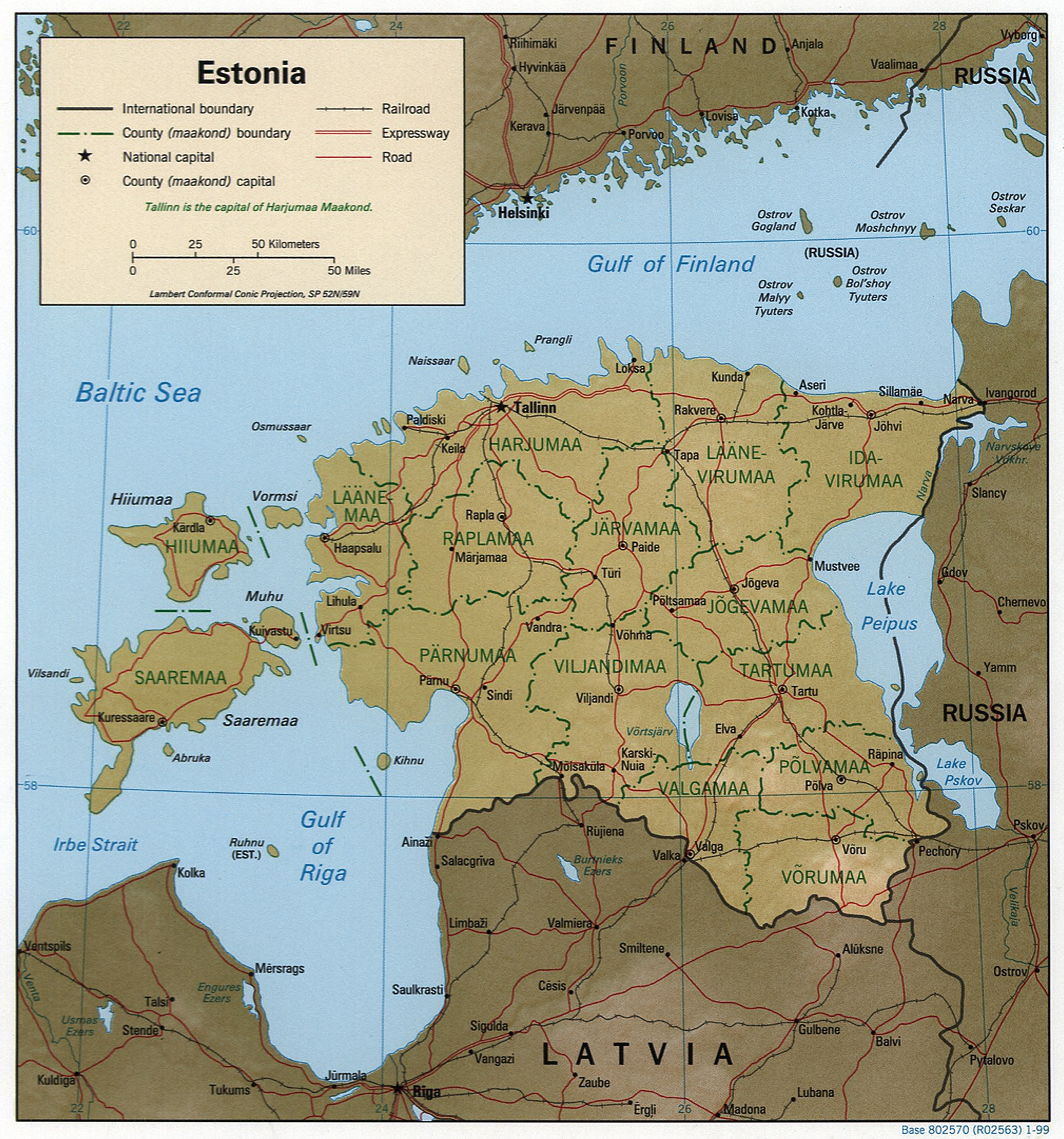
Estonia.
United States. Central Intelligence Agency.
CREATED/PUBLISHED [Washington, D.C. : Central Intelligence Agency, 1999]
NOTES "Base 802570 (R02563) 1-99."
Relief shown by shading.
Also shows administrative divisions in green.
Also issued without shaded relief.
Includes note.
Scale [ca. 1:2,500,000] ; Lambert conformal conic proj. (E 210--E 290/N 610--N 570).
SUBJECTS Estonia--Maps. Estonia--Administrative and political divisions--Maps. Estonia.
MEDIUM 1 map : col. ; 18 x 17 cm.
CALL NUMBER G7030 1999 .U6
REPOSITORY Library of Congress Geography and Map Division Washington, D.C. 20540-4650 USA
DIGITAL ID g7030 ct000997 http://hdl.loc.gov/loc.gmd/g7030.ct000997
| This image is a work of a Central Intelligence Agency employee, taken or made during the course of the person's official duties. As a Work of the United States Government, all images created or made by the CIA are in the public domain, with the exception of classified information. |  |
File history
Click on a date/time to view the file as it appeared at that time.
| Date/Time | Dimensions | User | Comment | |
|---|---|---|---|---|
| current | 08:17, 27 October 2005 | 1,682×1,800 (1.55 MB) | Brian0918 | (Estonia. United States. Central Intelligence Agency. CREATED/PUBLISHED [Washington, D.C. : Central Intelligence Agency, 1999] NOTES "Base 802570 (R02563) 1-99." Relief shown by shading. Also shows administrative divisions in green. Also issued witho) |
File links
Metadata
This file contains additional information, probably added from the digital camera or scanner used to create or digitize it. If the file has been modified from its original state, some details may not fully reflect the modified file.
| Width | 2449 |
|---|---|
| Height | 3175 |
| Compression scheme | Uncompressed |
| Pixel composition | RGB |
| Orientation | Normal |
| Number of components | 3 |
| Horizontal resolution | 72 dpi |
| Vertical resolution | 72 dpi |
| Software used | Adobe Photoshop CS2 Windows |
| File change date and time | 04:16, 27 October 2005 |
| Color space | 65535 |

