Image:Ernestine-map.png
From Wikipedia, the free encyclopedia
Size of this preview: 800 × 594 pixels
Full resolution (833 × 619 pixels, file size: 34 KB, MIME type: image/png)
| | This is a file from the Wikimedia Commons. The description on its description page there is shown below.
|
 |
This map has been uploaded by Electionworld from en.wikipedia.org to enable the |
[edit] Summary
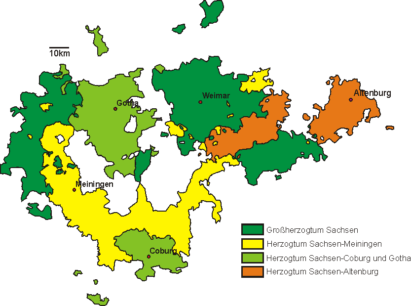
Image copied from the image "310px-Ernest.png" in the German language Wikipedia, which has the attribution, "Karte Thüringen 1910 mit Ernestinischen Herzogtümern selbst abgezeichnet GNU-FDL"
[edit] Licensing

File history
Click on a date/time to view the file as it appeared at that time.
| Date/Time | Dimensions | User | Comment | |
|---|---|---|---|---|
| current | 22:25, 22 December 2006 | 833×619 (34 KB) | Electionworld | ({{ew|en|Dalbury}} == Summary == Image copied from the image "310px-Ernest.png" in the German language Wikipedia, which has the attribution, "Karte Thüringen 1910 mit Ernestinischen Herzogtümern selbst abgezeichnet GNU-FDL" == Licensing == {{GFDL}} [[de) |
File links
The following pages on the English Wikipedia link to this file (pages on other projects are not listed):

