Image:Emancipation Proclamation.PNG
From Wikipedia, the free encyclopedia
Size of this preview: 800 × 520 pixels
Full resolution (1,513 × 983 pixels, file size: 171 KB, MIME type: image/png)
| | This is a file from the Wikimedia Commons. The description on its description page there is shown below.
|
| Description |
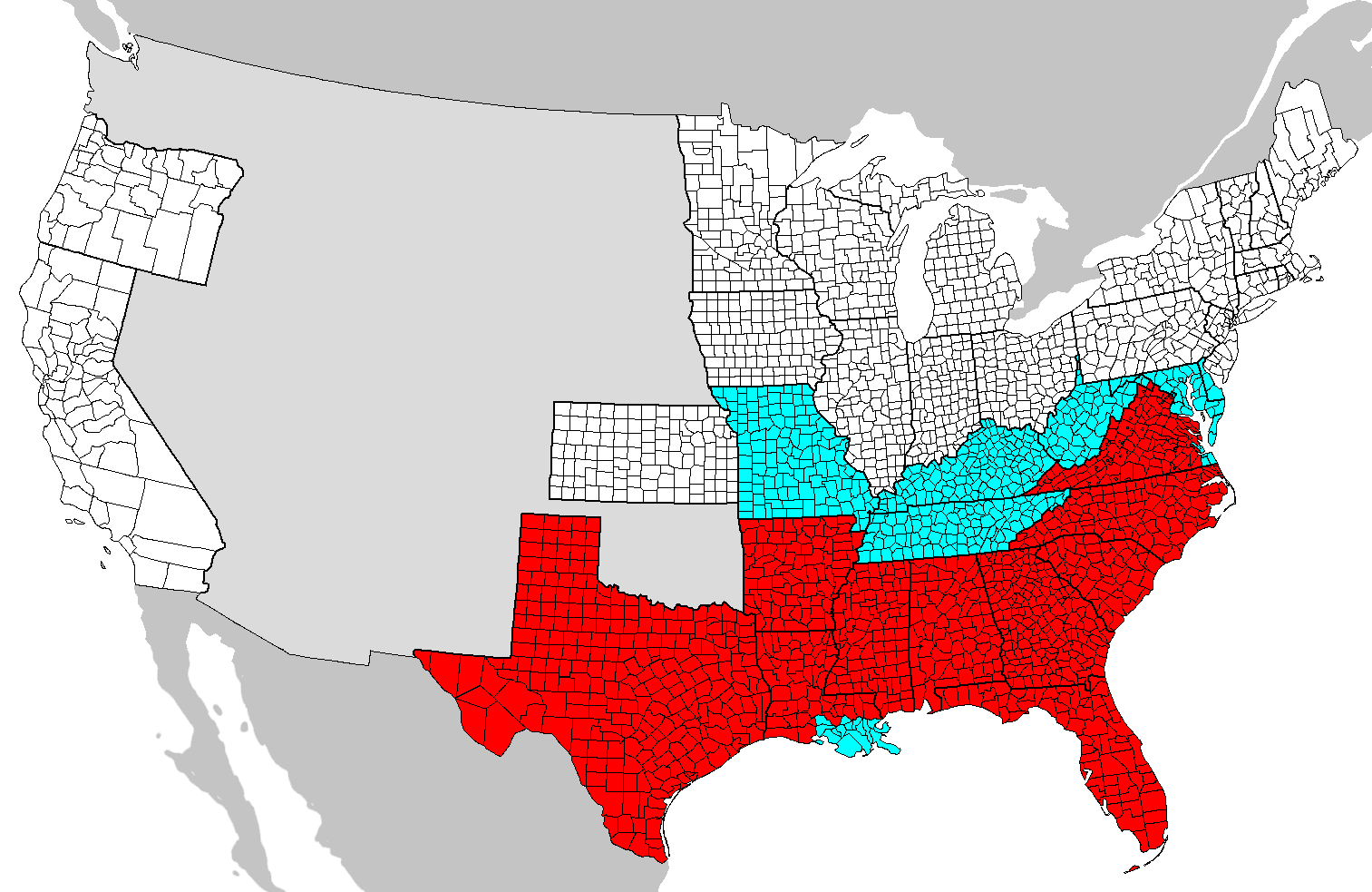
SummaryMap of counties covered and not covered by the Emancipation Proclamation. |
|---|---|
| Source | |
| Date |
2008-06-01 04:29 (UTC) |
| Author |
|
| Permission (Reusing this image) |
see below |
 |
This is a retouched picture, which means that it has been digitally altered from its original version. Modifications: Added colors. The original can be viewed here: Map_of_USA_with_county_outlines.png. Modifications made by SFGiants. |

[edit] Original upload log
This image is a derivative work of the following images:
- Image:Map_of_USA_with_county_outlines.png licensed with GFDL
- 2008-01-23T04:41:16Z Speight 1513x983 (100713 Bytes) Fix San Francisco Bay and Puget Sound
- 2006-11-23T22:53:51Z Ibagli 1513x983 (169345 Bytes) more fixes
- 2006-11-23T22:53:05Z Ibagli 1513x983 (169416 Bytes) Reverted to earlier revision
- 2006-11-23T22:52:41Z Ibagli 1513x983 (184378 Bytes) more fixes
- 2006-11-23T02:16:28Z Ibagli 1513x983 (169416 Bytes) fix lake St. Clair
- 2005-08-28T20:57:13Z Huhsunqu 1513x983 (169340 Bytes) *{{es}} Mapa de los [[Estados Unidos de América]] mostrando los los límites de estados miembros y sus condados. Versión a colores de la adaptación hecha por [[en:User:Wapcaplet|Wapcaplet]] del mapa de dominio público del
Uploaded with derivativeFX
File history
Click on a date/time to view the file as it appeared at that time.
| Date/Time | Dimensions | User | Comment | |
|---|---|---|---|---|
| current | 04:31, 1 June 2008 | 1,513×983 (171 KB) | SFGiants | ({{Information |Description=== Summary == Map of counties covered and not covered by the Emancipation Proclamation. |Source=*Image:Map_of_USA_with_county_outlines.png |Date=2008-06-01 04:29 (UTC) |Author=*derivative w) |
File links
The following pages on the English Wikipedia link to this file (pages on other projects are not listed):

