Image:El salvador land 1980.jpg
From Wikipedia, the free encyclopedia
Size of this preview: 587 × 599 pixels
Full resolution (666 × 680 pixels, file size: 103 KB, MIME type: image/jpeg)
| | This is a file from the Wikimedia Commons. The description on its description page there is shown below.
|
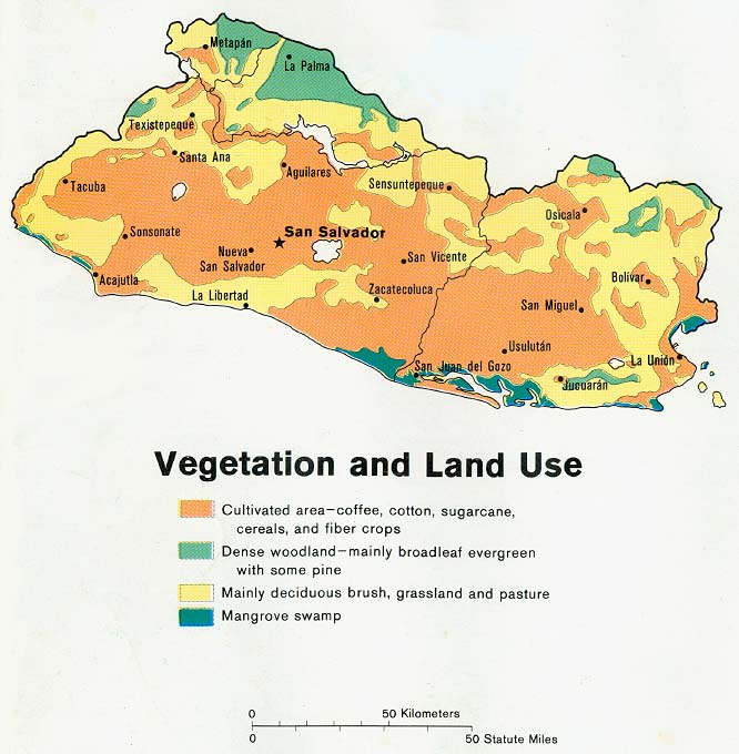
El Salvador
http://www.lib.utexas.edu/maps/el_salvador.html
| This image is a work of a Central Intelligence Agency employee, taken or made during the course of the person's official duties. As a Work of the United States Government, all images created or made by the CIA are in the public domain, with the exception of classified information. |  |
File history
Click on a date/time to view the file as it appeared at that time.
| Date/Time | Dimensions | User | Comment | |
|---|---|---|---|---|
| current | 06:06, 28 October 2005 | 666×680 (103 KB) | Brian0918 | (El Salvador http://www.lib.utexas.edu/maps/el_salvador.html {{PD-USGov-CIA}} Category:Maps of El Salvador) |
File links
The following pages on the English Wikipedia link to this file (pages on other projects are not listed):
Metadata
This file contains additional information, probably added from the digital camera or scanner used to create or digitize it. If the file has been modified from its original state, some details may not fully reflect the modified file.
| Orientation | Normal |
|---|---|
| Horizontal resolution | 150 dpi |
| Vertical resolution | 150 dpi |
| Software used | Adobe Photoshop 7.0 |
| File change date and time | 12:54, 4 March 2004 |
| Color space | 65535 |

