Image:EastshoreSPmap.png
From Wikipedia, the free encyclopedia
Size of this preview: 267 × 599 pixels
Full resolution (672 × 1,508 pixels, file size: 196 KB, MIME type: image/png)
| | This is a file from the Wikimedia Commons. The description on its description page there is shown below.
|
| Description |
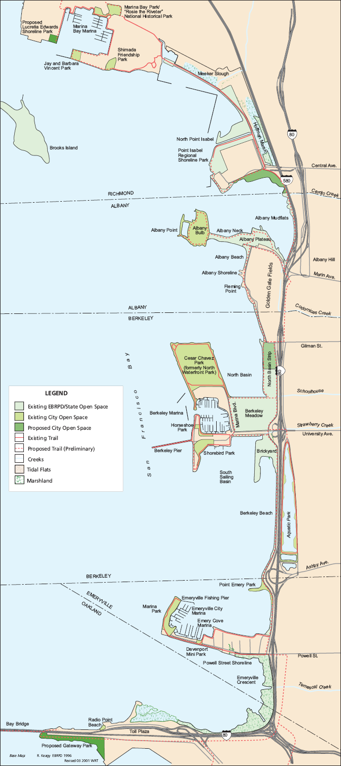
Map of Eastshore State Park, on the San Francisco Bay, California |
||
|---|---|---|---|
| Source |
http://www.parks.ca.gov/pages/21299/files/resource-summary-06-2001.pdf |
||
| Date |
June 2001 |
||
| Author |
LSA Associates, Inc. for California Department of Parks and Recreation, East Bay Regional Park District, California State Coastal Conservancy |
||
| Permission (Reusing this image) |
|
File history
Click on a date/time to view the file as it appeared at that time.
| Date/Time | Dimensions | User | Comment | |
|---|---|---|---|---|
| current | 18:35, 25 November 2007 | 672×1,508 (196 KB) | Dgies | ({{Information |Description=Map of Eastshore State Park, on the San Francisco Bay, California |Source=http://www.parks.ca.gov/pages/21299/files/resource-summary-06-2001.pdf |Date=June 2001 |Author=LSA Associates, Inc. for California Department of Parks and) |
File links
The following pages on the English Wikipedia link to this file (pages on other projects are not listed):

