Image:Dunas litoral bonaerense.jpg
From Wikipedia, the free encyclopedia
No higher resolution available.
Dunas_litoral_bonaerense.jpg (639 × 435 pixels, file size: 57 KB, MIME type: image/jpeg)
| | This is a file from the Wikimedia Commons. The description on its description page there is shown below.
|
[edit] Summary
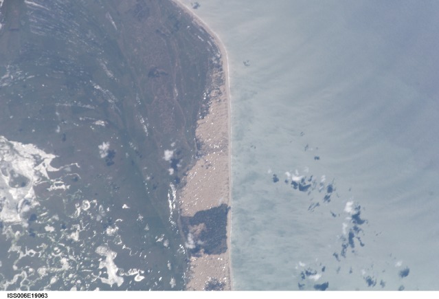
Paisaje de dunas del litoral bonaerense NASA Date: 20030113 (YYYYMMDD)GMT Time: 155306 (HHMMSS) Nadir Point Latitude: -36.8, Longitude: -58.4 (Negative numbers indicate south for latitude and west for longitude) Nadir to Photo Center Direction: East Sun Azimuth: 8 (Clockwise angle in degrees from north to the sun measured at the nadir point) Spacecraft Altitude: 398 km Sun Elevation Angle: 75 (Angle in degrees between the horizon and the sun, measured at the nadir point) Orbit Number: 3689
[edit] Licensing
|
|
This file is in the public domain because it was created by NASA. NASA copyright policy states that "NASA material is not protected by copyright unless noted". (NASA copyright policy page or JPL Image Use Policy).
Deutsch | English | Español | Français | Nederlands | Português | Русский | 中文(简体) | 中文(繁體) | +/- |
|
 |
Warnings:
|
File history
Click on a date/time to view the file as it appeared at that time.
| Date/Time | Dimensions | User | Comment | |
|---|---|---|---|---|
| current | 03:41, 4 July 2006 | 639×435 (57 KB) | Rosarinagazo | (Paisaje de dunas del litoral bonaerense NASA Date: 20030113 (YYYYMMDD)GMT Time: 155306 (HHMMSS) Nadir Point Latitude: -36.8, Longitude: -58.4 (Negative numbers indicate south for latitude and west for longitude) Nadir to Photo Center Direction: East Sun A) |
File links
The following pages on the English Wikipedia link to this file (pages on other projects are not listed):

