Image:Drury lane inset map.png
From Wikipedia, the free encyclopedia
No higher resolution available.
Drury_lane_inset_map.png (613 × 372 pixels, file size: 377 KB, MIME type: image/png)
| | This is a file from the Wikimedia Commons. The description on its description page there is shown below.
|
[edit] Summary
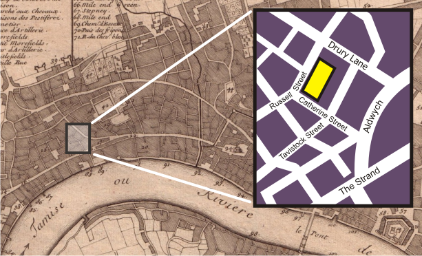
Moved from English Wikipedia:
The background of this image is a section of the Public Domain http://commons.wikimedia.org/wiki/Image:Nicolas_de_fer_1700_london.jpg , a 1700 map of London. The inset map, showing the blocks around the Theatre Royal, Drury Lane in 2006, was drawn by myself, Bunchofgrapes, in Corel Draw.
[edit] Licensing

File history
Click on a date/time to view the file as it appeared at that time.
| Date/Time | Dimensions | User | Comment | |
|---|---|---|---|---|
| current | 19:41, 12 March 2007 | 613×372 (377 KB) | Galileo01 | (Moved from English Wikipedia: ''The background of this image is a section of the Public Domain http://commons.wikimedia.org/wiki/Image:Nicolas_de_fer_1700_london.jpg , a 1700 map of London. The inset map, showing the blocks around the Theatre Royal, Drur) |
File links
The following pages on the English Wikipedia link to this file (pages on other projects are not listed):

