Image:Districts of Lesotho.png
From Wikipedia, the free encyclopedia
No higher resolution available.
Districts_of_Lesotho.png (268 × 263 pixels, file size: 31 KB, MIME type: image/png)
| | This is a file from the Wikimedia Commons. The description on its description page there is shown below.
|
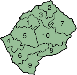
Districts of Lesotho.
Map by Snoyes. Originally uploaded in the English Wikipedia under the GFDL.

File history
Click on a date/time to view the file as it appeared at that time.
| Date/Time | Dimensions | User | Comment | |
|---|---|---|---|---|
| current | 15:33, 14 January 2006 | 268×263 (31 KB) | Kooma | (Districts of Lesotho. Map by Snoyes. Originally uploaded in the English Wikipedia under the GFDL. {{GFDL}} Category:Maps of Lesotho) |
File links
The following pages on the English Wikipedia link to this file (pages on other projects are not listed):

