Image:Cumberlandplateaumap.png
From Wikipedia, the free encyclopedia
No higher resolution available.
Cumberlandplateaumap.png (600 × 600 pixels, file size: 539 KB, MIME type: image/png)
| | This is a file from the Wikimedia Commons. The description on its description page there is shown below.
|
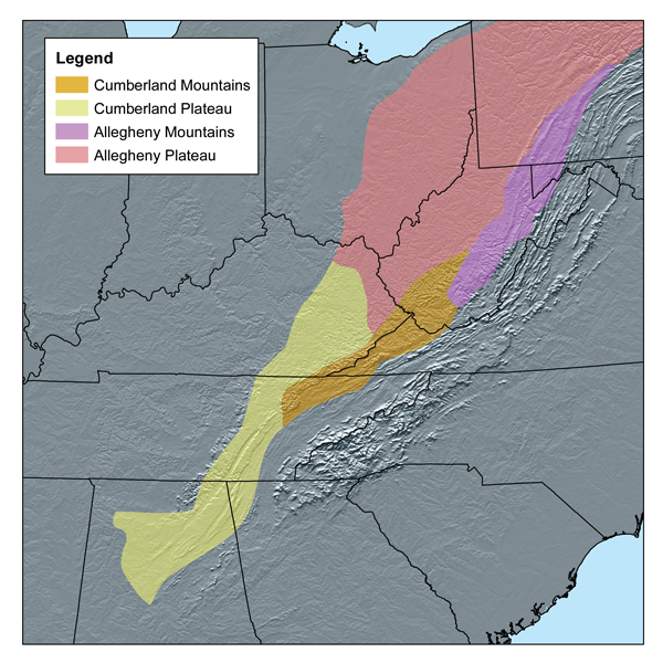
This map shows the subdivisions of the southern Appalachian Plateau as defined by Bailey's ecoregions.[1] I, Karl Musser, created it based on USGS.
|
File history
Click on a date/time to view the file as it appeared at that time.
| Date/Time | Dimensions | User | Comment | |
|---|---|---|---|---|
| current | 14:56, 20 March 2007 | 600×600 (539 KB) | Kmusser | (This map shows the subdivisions of the southern Appalachian Plateau as defined by Bailey's ecoregions.[http://www.fs.fed.us/rm/analytics/publications/ecoregionsindex.html] I, Karl Musser, created it based o) |
File links
The following pages on the English Wikipedia link to this file (pages on other projects are not listed):

