Image:Clementine albedo simp750.jpg
From Wikipedia, the free encyclopedia
Size of this preview: 800 × 400 pixels
Full resolution (1,080 × 540 pixels, file size: 204 KB, MIME type: image/jpeg)
| | This is a file from the Wikimedia Commons. The description on its description page there is shown below.
|
[edit] Summary
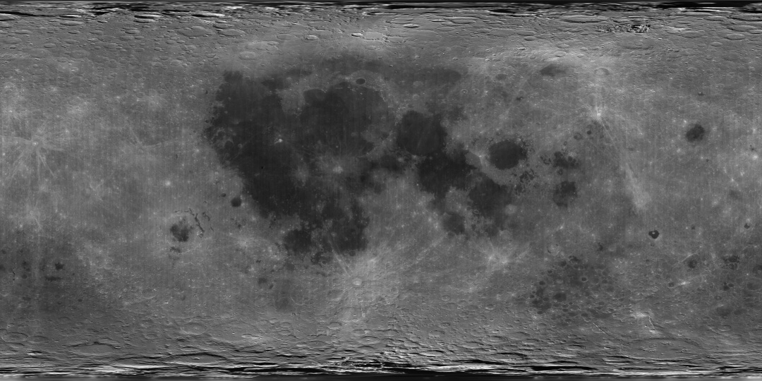
| Description |
English: A global albedo map of the Moon obtained from the Clementine mission. The dark regions are the lunar maria, whereas the lighter regions are the highlands. The image is a cylindrical projection, with longitude increasing left to right from -180 E to 180 E and latitude decreasing from top to bottom from 90 N to 90 S. The center of the image corresponds to the mean sub-Earth point, 0 N and 0 E.
|
|---|---|
| Source |
direct source found on here |
| Date | |
| Author |
Image processing by the U.S. Geological Survey in Flagstaff, Arizona. |
| Permission (Reusing this image) |
see below |
[edit] Licensing
| This image is in the public domain because it contains materials that originally came from the United States Geological Survey, an agency of the United States Department of Interior. For more information, see the official USGS copyright policy |
|
File history
Click on a date/time to view the file as it appeared at that time.
| Date/Time | Dimensions | User | Comment | |
|---|---|---|---|---|
| current | 10:39, 4 April 2007 | 1,080×540 (204 KB) | Yonatanh | (== Summary == {{Information |Description={{en|A global albedo map of the Moon obtained from the Clementine mission. The dark regions are the lunar maria, whereas the lighter regions are the highlands. The image is a cylindrical projection, with longitude ) |
File links
The following pages on the English Wikipedia link to this file (pages on other projects are not listed):

