Image:Charlestown Navy Yard Mystic Wharf Map 1912.jpg
From Wikipedia, the free encyclopedia
No higher resolution available.
Charlestown_Navy_Yard_Mystic_Wharf_Map_1912.jpg (500 × 347 pixels, file size: 34 KB, MIME type: image/jpeg)
| | This is a file from the Wikimedia Commons. The description on its description page there is shown below.
|
| Description |
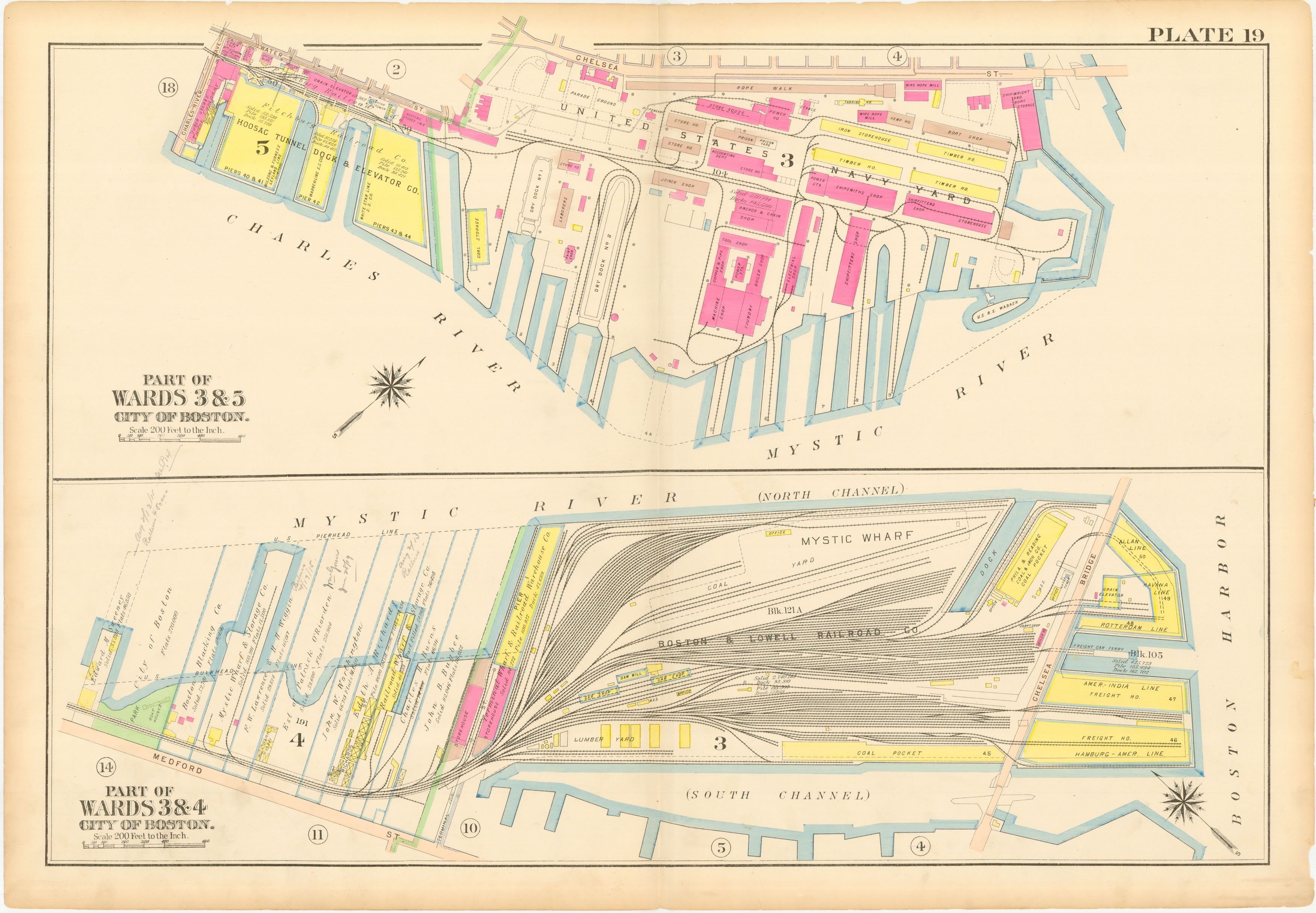
English: This is a map of the Charlestown Navy Yard and Mystic Wharf in 1912. The map is from an atlas of Charlestown, Massachusetts published by GW Bromley. The map's original size is about 22"x32".
Source: downloaded from http://wardmaps.com/ward_maps/charlestown_1912/charlestown_1912_plate_19.htm en:Category:Maps of Boston, Massachusetts |
|---|---|
| Source |
Transfered from en.wikipedia |
| Date |
2006-05-31 (original upload date) |
| Author |
Original uploader was Bluemanboston at en.wikipedia |
| Permission (Reusing this image) |
PD-US. |
[edit] License information
|
|
This media file is in the public domain in the United States. This applies to U.S. works where the copyright has expired, often because its first publication occurred prior to January 1, 1923. See this page for further explanation.
|
|
|
Deutsch | English | Español | Français | Gaeilge | Galego | Italiano | Nederlands | 中文(简体) | +/- |
||
|
|
This image might not be in the public domain outside of the United States (this especially applies in Canada, China (not Hong Kong, Macao, or Taiwan Area), Germany, Mexico, and Switzerland). The creator and year of publication are essential information and must be provided. See Wikipedia:Public domain and Wikipedia:Copyrights for more details. |
[edit] Original upload log
The original description page is/was here. All following user names refer to en.wikipedia.
- 2006-05-31 19:54 Bluemanboston 500×347×8 (35244 bytes) This is a map of the Charlestown Navy Yard and Mystic Wharf in 1912. The map is from an atlas of Charlestown, Massachusetts published by GW Bromley. The map's original size is about 22"x32". Source: downloaded from http://wardmaps.com/ward_maps/charlesto
File history
Click on a date/time to view the file as it appeared at that time.
| Date/Time | Dimensions | User | Comment | |
|---|---|---|---|---|
| current | 12:11, 30 December 2007 | 500×347 (34 KB) | PMG | ({{Information |Description={{en|This is a map of the Charlestown Navy Yard and Mystic Wharf in 1912. The map is from an atlas of Charlestown, Massachusetts published by GW Bromley. The map's original size is about 22"x32". Source: downloaded from http://) |
File links
The following pages on the English Wikipedia link to this file (pages on other projects are not listed):

