Image:Chagos large.png
From Wikipedia, the free encyclopedia
Size of this preview: 404 × 600 pixels
Full resolution (1,311 × 1,947 pixels, file size: 1.28 MB, MIME type: image/png)
| | This is a file from the Wikimedia Commons. The description on its description page there is shown below.
|
[edit] Summary
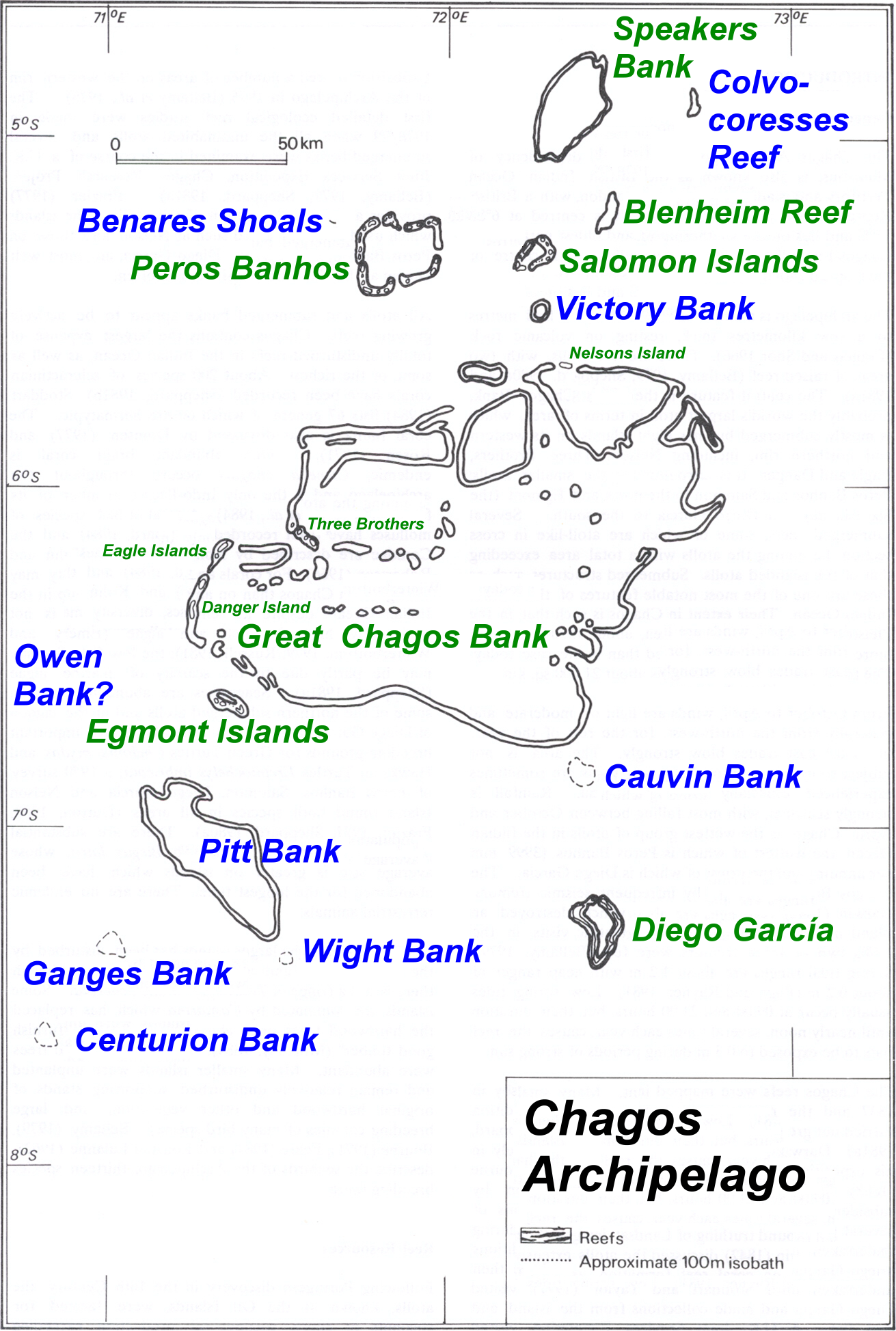
| Description |
Map of Chagos-Archipelago in the Indian Ocean. |
|---|---|
| Source |
taken from http://www.coral.noaa.gov/reef_maps/volume2/chagos_large.jpg plus atoll and island names completed and rewritten |
| Date | |
| Author |
NOAA |
| Permission (Reusing this image) |
see below |
[edit] Original Upload Log
| date/time | username | Dimensions | File Size | edit summary |
|---|---|---|---|---|
| 11:01, 30 July 2006 | en:User:Ratzer | 1311×1947 | 1.28 MB | base map from http://www.coral.noaa.gov/reef_maps/volume2/chagos_large.jpg, plus atoll and island names completed and rewritten |
[edit] Licensing
| This image is in the public domain because it contains materials that originally came from the U.S. National Oceanic and Atmospheric Administration, taken or made during the course of an employee's official duties. |
|
File history
Click on a date/time to view the file as it appeared at that time.
| Date/Time | Dimensions | User | Comment | |
|---|---|---|---|---|
| current | 08:43, 14 March 2008 | 1,311×1,947 (1.28 MB) | Telim tor | (== Summary == {{Information |Description=Map of Chagos-Archipelago in the Indian Ocean. |Source=taken from http://www.coral.noaa.gov/reef_maps/volume2/chagos_large.jpg plus atoll and island names completed and rewritten |Date= |Author=NOAA |Permission= |o) |
File links
The following pages on the English Wikipedia link to this file (pages on other projects are not listed):

