Image:Central Asia Physical.jpg
From Wikipedia, the free encyclopedia
No higher resolution available.
Central_Asia_Physical.jpg (646 × 391 pixels, file size: 114 KB, MIME type: image/jpeg)
| | This is a file from the Wikimedia Commons. The description on its description page there is shown below.
|
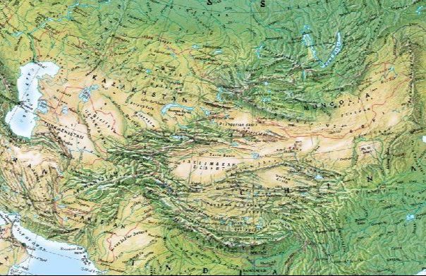
This image is a physical map of Central Asia.
This image was produced using the National Geographic Map Machine, and is ©2004 ESRI GRS. According to the Geography Network Free Resources page, Map Machine content "you may use freely."
 |
The copyright holder of this work allows anyone to use it for any purpose including unrestricted redistribution, commercial use, and modification.
Note: العربية | Asturianu | Български | Česky | Dansk | Deutsch | English | Esperanto | Español | فارسی | Français | Galego | Italiano | 日本語 | 한국어 | Kurdî / كوردی | Nederlands | Polski | Português | Русский | Suomi | Svenska | Türkçe | Shqip | 中文(简体) | 中文(繁體) | 粵語 | +/- |
File history
Click on a date/time to view the file as it appeared at that time.
| Date/Time | Dimensions | User | Comment | |
|---|---|---|---|---|
| current | 18:48, 10 May 2005 | 646×391 (114 KB) | Shauni | (This image is a physical map of Central Asia. This image was produced using the [http://mapmachine.nationalgeographic.com/mapmachine/ National Geographic Map Machine], and is ©2004 ESRI GRS. According to the [http://www.geographynetwork.co) |
File links
The following pages on the English Wikipedia link to this file (pages on other projects are not listed):

