Image:Catfish Pond Control Structure.jpg
From Wikipedia, the free encyclopedia
Size of this preview: 800 × 533 pixels
Full resolution (1,500 × 999 pixels, file size: 607 KB, MIME type: image/jpeg)
| | This is a file from the Wikimedia Commons. The description on its description page there is shown below.
|
| Description |
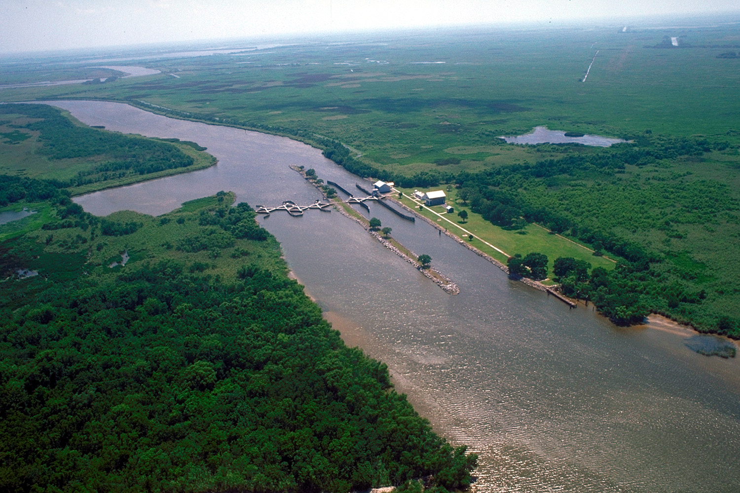
English: Catfish Point Control Structure, at the outlet of Grand Lake into the Mermentau River, which flows into Vermilion Bay in the Gulf of Mexico. The lock is located in at the east end of Cameron Parish, Louisiana, USA. This lock is a salt water intrusion barrier to prevent the waters from the Gulf of Mexico from intruding into Grand Lake and the freshwater bayous and rivers.
|
|||
|---|---|---|---|---|
| Source |
U.S. Army Corps of Engineers Digital Visual Library |
|||
| Date |
1998-06-15 |
|||
| Author |
Arthur Belala, U.S. Army Corps of Engineers |
|||
| Permission (Reusing this image) |
|
| Camera location | This and other geocoded Commons images: | (Info) |
|---|
File history
Click on a date/time to view the file as it appeared at that time.
| Date/Time | Dimensions | User | Comment | |
|---|---|---|---|---|
| current | 04:42, 5 April 2007 | 1,500×999 (607 KB) | DanMS | ({{Information | Description = {{en|Catfish Point Control Structure, Mermentau River, at Grand Lake, Louisiana, USA. This lock is a salt water intrusion barrier to prevent the waters from the Gulf of Mexico from intruding into the freshwater bayous and ) |
File links
The following pages on the English Wikipedia link to this file (pages on other projects are not listed):

