Image:Carte Lycie.png
From Wikipedia, the free encyclopedia
No higher resolution available.
Carte_Lycie.png (483 × 444 pixels, file size: 48 KB, MIME type: image/png)
| | This is a file from the Wikimedia Commons. The description on its description page there is shown below.
|
[edit] Summary
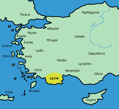
English: Map of Lycia in French. Adaptated from Image:Turkey ancient region map ionia.JPG.
Français : Carte montrant l'emplacement de la Lycie en Asie Mineure. Carte créée et adaptée de Image:Turkey ancient region map ionia.JPG.
[edit] Licensing

File history
Click on a date/time to view the file as it appeared at that time.
| Date/Time | Dimensions | User | Comment | |
|---|---|---|---|---|
| current | 14:11, 29 August 2006 | 483×444 (48 KB) | Bibi Saint-Pol | (décalage Mysie) |
| 00:32, 29 August 2006 | 483×444 (48 KB) | Bibi Saint-Pol | (== Summary == {{en|Map of Lycia in French. Adaptated from Image:Turkey ancient region map ionia.JPG.}} {{fr|Carte montrant l'emplacement de la Lycie en Asie Mineure. Carte créée et adaptée de Image:Turkey ancient region map ionia.JPG.}} == L) |
File links
The following pages on the English Wikipedia link to this file (pages on other projects are not listed):

