Image:Cape Girardeau Missouri 1993.jpg
From Wikipedia, the free encyclopedia
Size of this preview: 800 × 534 pixels
Full resolution (1,500 × 1,001 pixels, file size: 534 KB, MIME type: image/jpeg)
| | This is a file from the Wikimedia Commons. The description on its description page there is shown below.
|
| Description |
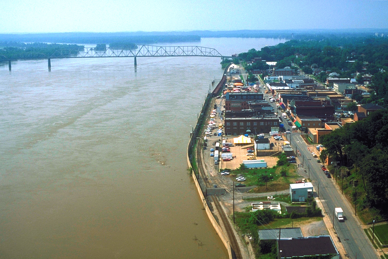
English: Aerial view of the waterfront section of Cape Girardeau, Missouri, USA, along the River. The picture was taken during the flood of 1993. The floowalls built by the U.S. Army Corps of Engineers are protecting the city from flooding. This picture was taken before the new bridge across the Mississippi was built in 2003.
|
|||
|---|---|---|---|---|
| Source |
U.S. Army Corps of Engineers Digital Visual Library |
|||
| Date |
1993 |
|||
| Author |
U.S. Army Corps of Engineers, photographer not specified or unknown |
|||
| Permission (Reusing this image) |
|
| Camera location | This and other geocoded Commons images: | (Info) |
|---|
File history
Click on a date/time to view the file as it appeared at that time.
| Date/Time | Dimensions | User | Comment | |
|---|---|---|---|---|
| current | 00:34, 5 April 2007 | 1,500×1,001 (534 KB) | DanMS | ({{Information | Description = {{en|Aerial view of the waterfront section of Cape Girardeau, Missouri, USA, along the Mississippi River. The picture was taken during the flood of 1993. The floowalls built by the U.S. Army Corps of Engineers are protecti) |
File links
The following pages on the English Wikipedia link to this file (pages on other projects are not listed):

