Image:CapeHorn ASTER 2005sep20.jpg
From Wikipedia, the free encyclopedia
Size of this preview: 768 × 599 pixels
Full resolution (3,207 × 2,503 pixels, file size: 875 KB, MIME type: image/jpeg)
| | This is a file from the Wikimedia Commons. The description on its description page there is shown below.
|
[edit] Summary
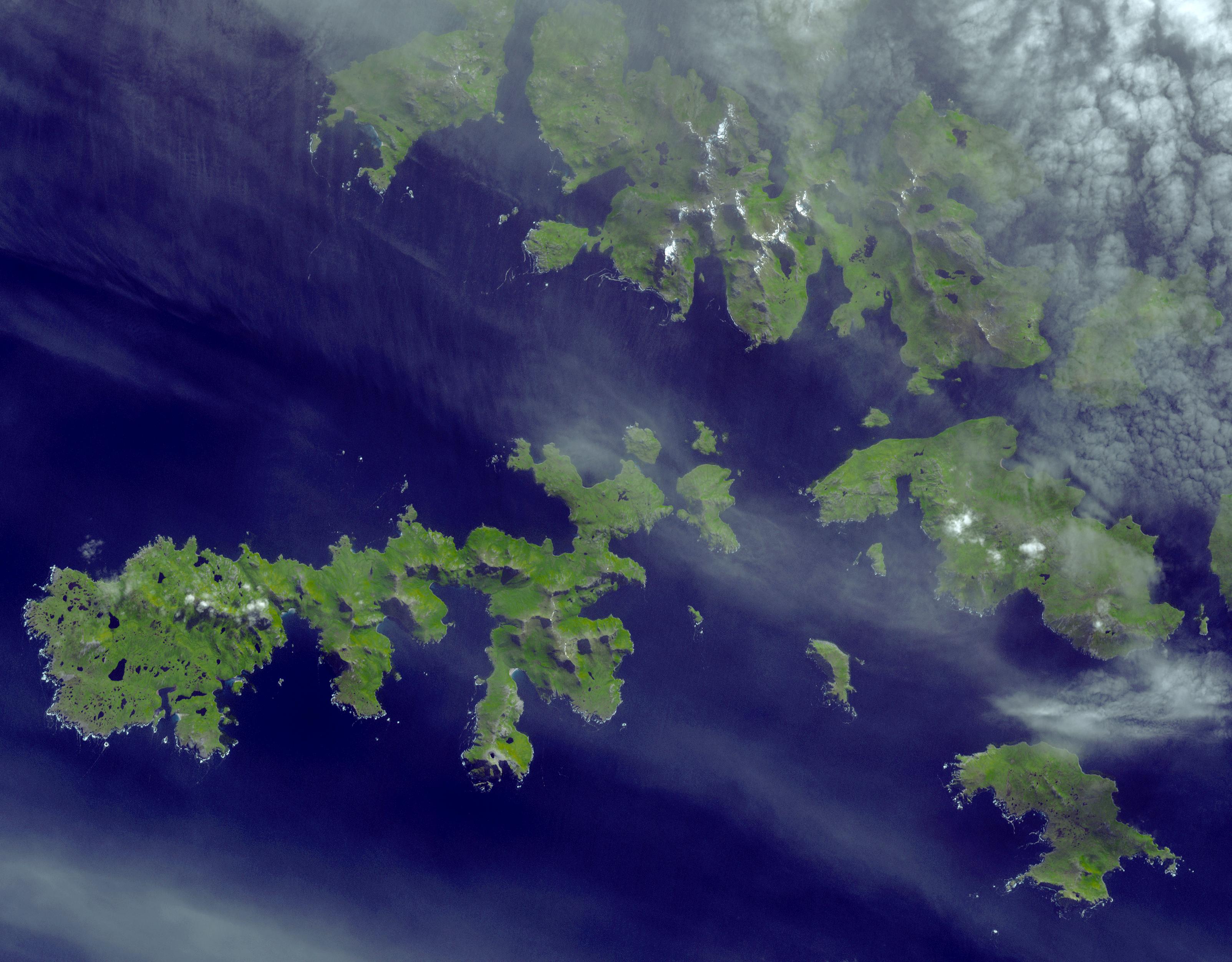
| Description |
Satellite image of the w:Wollaston Islands (upper right), the w:Hermite Islands (center) and w:Cape Horn (lower right) |
|---|---|
| Source |
http://earthobservatory.nasa.gov/Newsroom/NewImages/images.php3?img_id=17271 |
| Date |
September 20, 2005 |
| Author |
NASA/GSFC/METI/ERSDAC/JAROS, and U.S./Japan ASTER Science Team |
| Permission (Reusing this image) |
Public domain |
[edit] Licensing
|
|
This file is in the public domain because it was created by NASA. NASA copyright policy states that "NASA material is not protected by copyright unless noted". (NASA copyright policy page or JPL Image Use Policy).
Deutsch | English | Español | Français | Nederlands | Português | Русский | 中文(简体) | 中文(繁體) | +/- |
|
 |
Warnings:
|
File history
Click on a date/time to view the file as it appeared at that time.
| Date/Time | Dimensions | User | Comment | |
|---|---|---|---|---|
| current | 19:58, 11 May 2006 | 3,207×2,503 (875 KB) | Howcheng | ({{Information | Description=Satellite image of the w:Hermite Islands and w:Cape Horn. | Source=http://earthobservatory.nasa.gov/Newsroom/NewImages/images.php3?img_id=17271 | Date=September 20, 2005 | Author=NASA/GSFC/METI/ERSDAC/JAROS, and U.S./Ja) |
File links
The following pages on the English Wikipedia link to this file (pages on other projects are not listed):

