Image:Canada provinces 1881-1886.png
From Wikipedia, the free encyclopedia
Size of this preview: 694 × 600 pixels
Full resolution (1,000 × 864 pixels, file size: 47 KB, MIME type: image/png)
| | This is a file from the Wikimedia Commons. The description on its description page there is shown below.
|
[edit] Summary
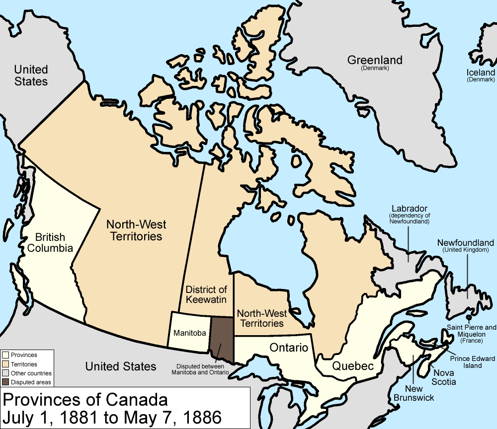
Map of the provinces and territories of Canada as they were between 1881 and 1886. On July 1 1881, Manitoba greatly expanded, using land from the North-West Territories and the District of Keewatin, but a large portion becomes disputed with Ontario. In 1886, the southwestern borders of the District of Keewatin were altered a little, giving a little land to the North-West Territories.
Made by User:Golbez.
[edit] Licensing
|

File history
Click on a date/time to view the file as it appeared at that time.
| Date/Time | Dimensions | User | Comment | |
|---|---|---|---|---|
| current | 09:59, 7 August 2006 | 1,000×864 (47 KB) | Golbez | (with legend) |
| 02:24, 18 February 2006 | 1,000×864 (45 KB) | Golbez | (Better version) | |
| 23:46, 13 February 2006 | 1,000×864 (42 KB) | Golbez | (better colors) | |
| 10:52, 13 February 2006 | 1,000×864 (42 KB) | Golbez | (date) | |
| 10:02, 13 February 2006 | 1,000×864 (41 KB) | Golbez | (Map of the provinces and territories of Canada as they were between 1881 and 1886. In 1881, Manitoba greatly expanded, using land from the North-West Territories and the District of Keewatin. In 1886, the southwestern borders of the District of Keewatin w) |
File links
The following pages on the English Wikipedia link to this file (pages on other projects are not listed):

