Image:Camp-Academia-Map.jpg
From Wikipedia, the free encyclopedia
Size of this preview: 633 × 599 pixels
Full resolution (2,070 × 1,959 pixels, file size: 2.4 MB, MIME type: image/jpeg)
| | This is a file from the Wikimedia Commons. The description on its description page there is shown below.
|
[edit] Summary
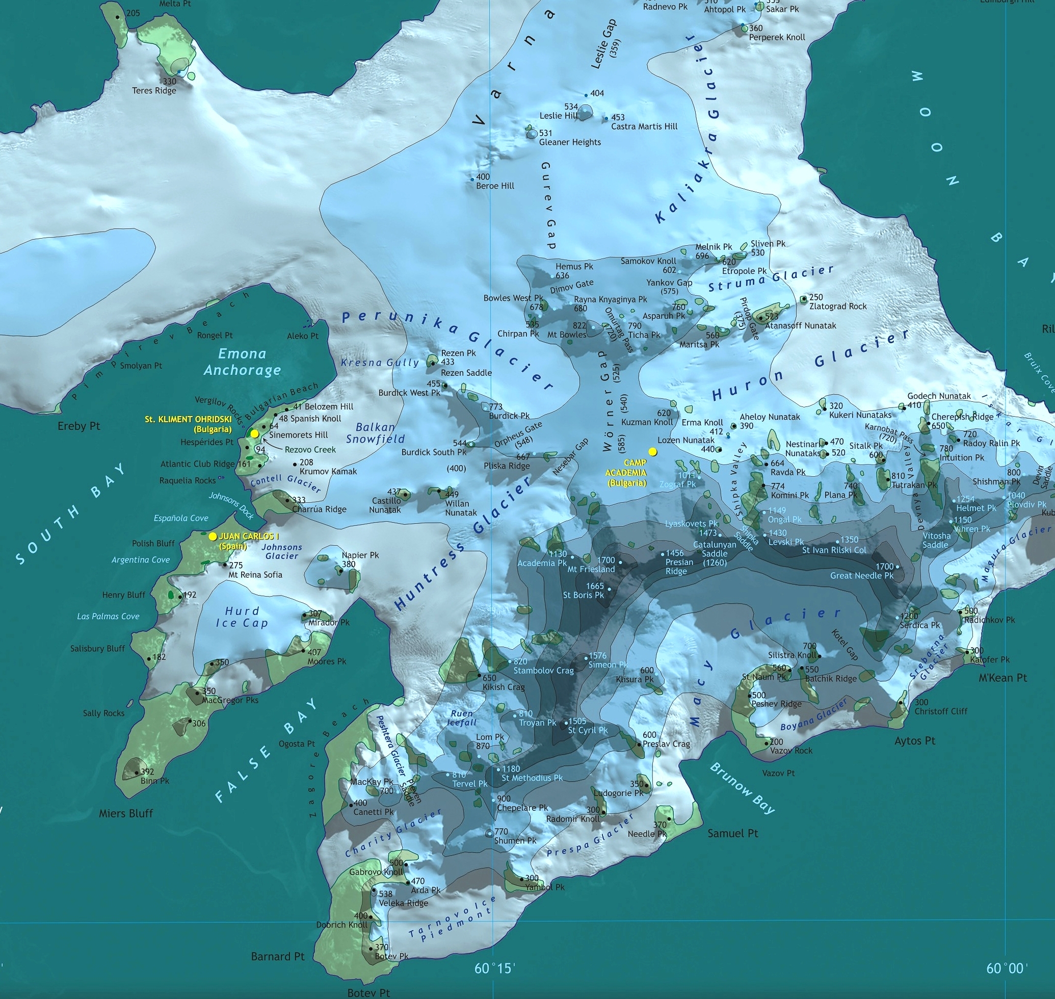
Español: La región central de la Isla Livingston con las bases San Clemente de Ohrid, Juan Carlos I, y Campo Académia
L.L. Ivanov et al, Antarctica: Livingston Island, South Shetland Islands (from English Strait to Morton Strait, with illustrations and ice-cover distribution), 1:100000 scale topographic map, Antarctic Place-names Commission of Bulgaria, Sofia, 2005 (Fragment)
Fragment released in the public domain by the Antarctic Place-names Commission of Bulgaria.
[edit] Licensing
 |
This work is free software; you can redistribute it and/or modify it under the terms of the GNU General Public License as published by the Free Software Foundation; either version 2 of the License, or any later version. This work is distributed in the hope that it will be useful, but WITHOUT ANY WARRANTY; without even the implied warranty of MERCHANTABILITY or FITNESS FOR A PARTICULAR PURPOSE. See version 2 and version 3 of the GNU General Public License for more details.
العربية | Català | Česky | Deutsch | Ελληνικά | English | Español | فارسی | Français | Italiano | 日本語 | Nederlands | Polski | Português | Русский | Slovenčina | Svenska | Türkçe | 中文(简体) | 中文(繁體) | +/- |
File history
Click on a date/time to view the file as it appeared at that time.
| Date/Time | Dimensions | User | Comment | |
|---|---|---|---|---|
| current | 07:28, 11 June 2006 | 2,070×1,959 (2.4 MB) | Apcbg | (L.L. Ivanov et al, Antarctica: Livingston Island, South Shetland Islands (from English Strait to Morton Strait, with illustrations and ice-cover distribution), 1:100000 scale topographic map, Antarctic Place-names Commission of Bulgaria, Sofia, 2005 (Frag) |
File links
The following pages on the English Wikipedia link to this file (pages on other projects are not listed):

