Image:Camargue map.png
From Wikipedia, the free encyclopedia
No higher resolution available.
Camargue_map.png (720 × 398 pixels, file size: 41 KB, MIME type: image/png)
| | This is a file from the Wikimedia Commons. The description on its description page there is shown below.
|
[edit] Summary
| Description | ||||
|---|---|---|---|---|
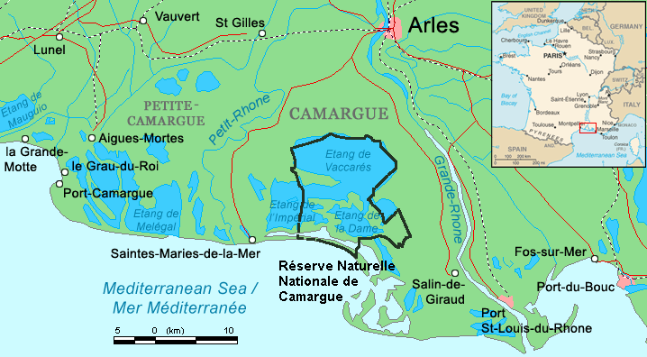
| Source |
Combination of CIA World Factbook map (Image:Fr-map.png) and Demis Map Server (http://www2.demis.nl/mapserver/mapper.asp) data with additional annotations and modifications by self. |
|||
| Date |
16 August 2006 |
|||
| Author | ||||
| Permission (Reusing this image) |
|

File history
Click on a date/time to view the file as it appeared at that time.
| Date/Time | Dimensions | User | Comment | |
|---|---|---|---|---|
| current | 20:52, 16 August 2006 | 720×398 (41 KB) | ChrisO | (Map of the Camargue region, southern France By ~~~, derived from open source mapping) |
| 20:46, 16 August 2006 | 720×398 (40 KB) | ChrisO | (Map of the Camargue region, southern France By ~~~, derived from open source mapping) |
File links
The following pages on the English Wikipedia link to this file (pages on other projects are not listed):

