Image:Buenos aires province numbered.png
From Wikipedia, the free encyclopedia
Size of this preview: 549 × 599 pixels
Full resolution (569 × 621 pixels, file size: 36 KB, MIME type: image/png)
| | This is a file from the Wikimedia Commons. The description on its description page there is shown below.
|
Contents |
[edit] Summary
[edit] Summary
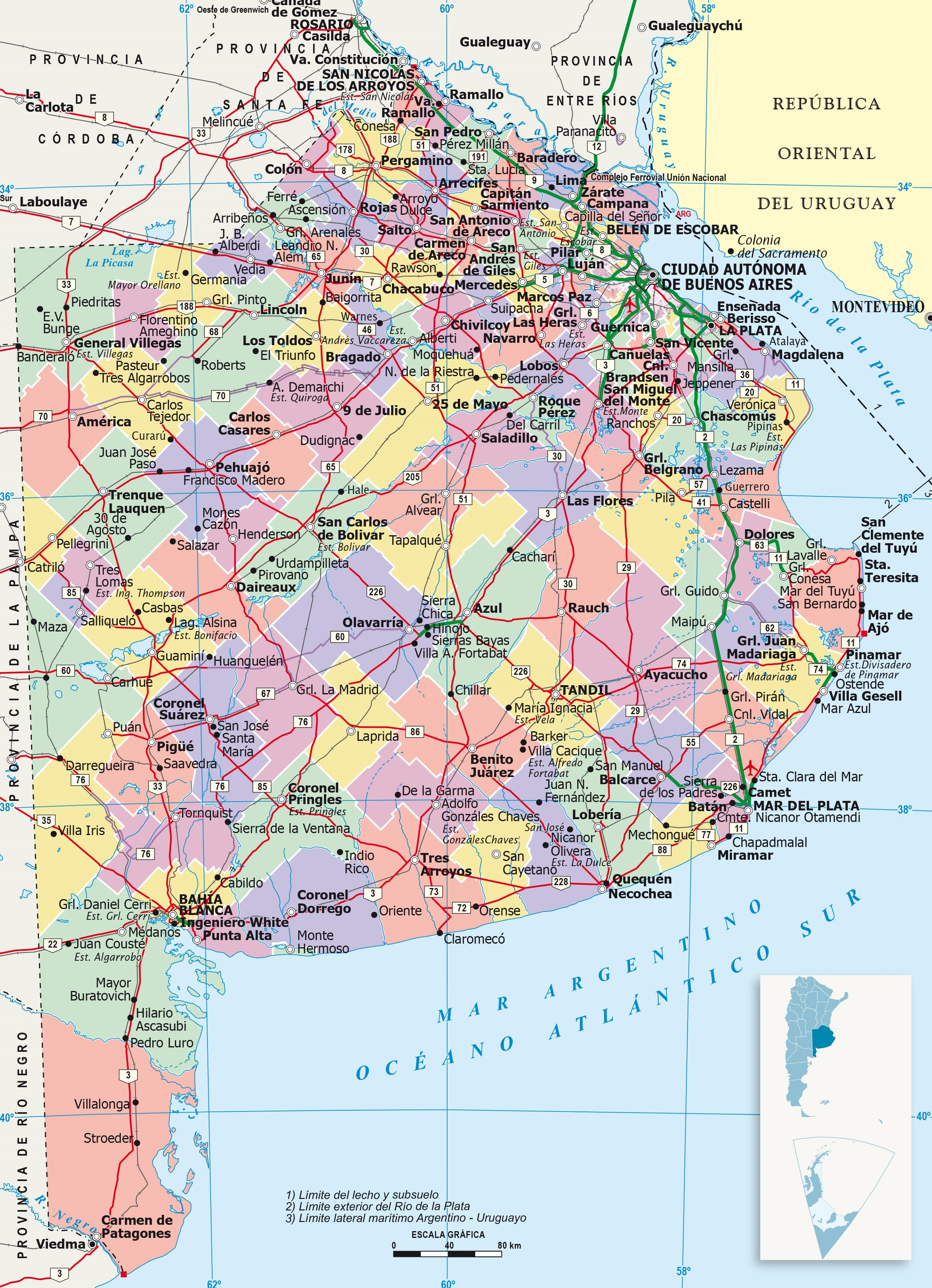
It shows administrative division of Buenos Aires province, its capital (red point) and its boundaries. This version has reference numbers for easier locating of provinces.
[edit] Licensing
| I, the copyright holder of this work, hereby release it into the public domain. This applies worldwide. In case this is not legally possible: Afrikaans | Alemannisch | Aragonés | العربية | Asturianu | Български | Català | Česky | Cymraeg | Dansk | Deutsch | Eʋegbe | Ελληνικά | English | Español | Esperanto | Euskara | Estremeñu | فارسی | Français | Galego | 한국어 | हिन्दी | Hrvatski | Ido | Bahasa Indonesia | Íslenska | Italiano | עברית | Kurdî / كوردی | Latina | Lietuvių | Latviešu | Magyar | Македонски | Bahasa Melayu | Nederlands | Norsk (bokmål) | Norsk (nynorsk) | 日本語 | Polski | Português | Ripoarisch | Română | Русский | Shqip | Slovenčina | Slovenščina | Српски / Srpski | Svenska | ไทย | Tagalog | Türkçe | Українська | Tiếng Việt | Walon | 中文(简体) | 中文(繁體) | zh-yue-hant | +/- |
File history
Click on a date/time to view the file as it appeared at that time.
| Date/Time | Dimensions | User | Comment | |
|---|---|---|---|---|
| current | 03:15, 31 August 2007 | 569×621 (36 KB) | Joshbaumgartner | (== Summary == It shows administrative division of Buenos Aires province, its capital (red point) and its boundaries. This version has reference numbers for easier locating of provinces. == Licensing == {{PD-self}} [[Category:Maps of Buenos Aires Provinc) |

