Image:Brown Field Municipal Airport diagram.png
From Wikipedia, the free encyclopedia
Size of this preview: 410 × 600 pixels
Full resolution (768 × 1,123 pixels, file size: 188 KB, MIME type: image/png)
| | This is a file from the Wikimedia Commons. The description on its description page there is shown below.
|
 |
This map image should be recreated using vector graphics as an SVG file. This has several advantages; see Commons:Media for cleanup for more information. If an SVG form of this image is already available, please upload it. After uploading an SVG, replace this template with template {{Vector version available|new image name.svg}} in this image. |
|
العربية | Български | Català | Česky | Dansk | Deutsch | English | Esperanto | Español | Français | 한국어 | Italiano | Magyar | Lietuvių | Nederlands | 日本語 | Polski | Português | Română | Русский | Suomi | Svenska | Türkçe | Українська | Tiếng Việt | मराठी | 中文(繁體) | 中文(简体) | +/- |
|
| Description |
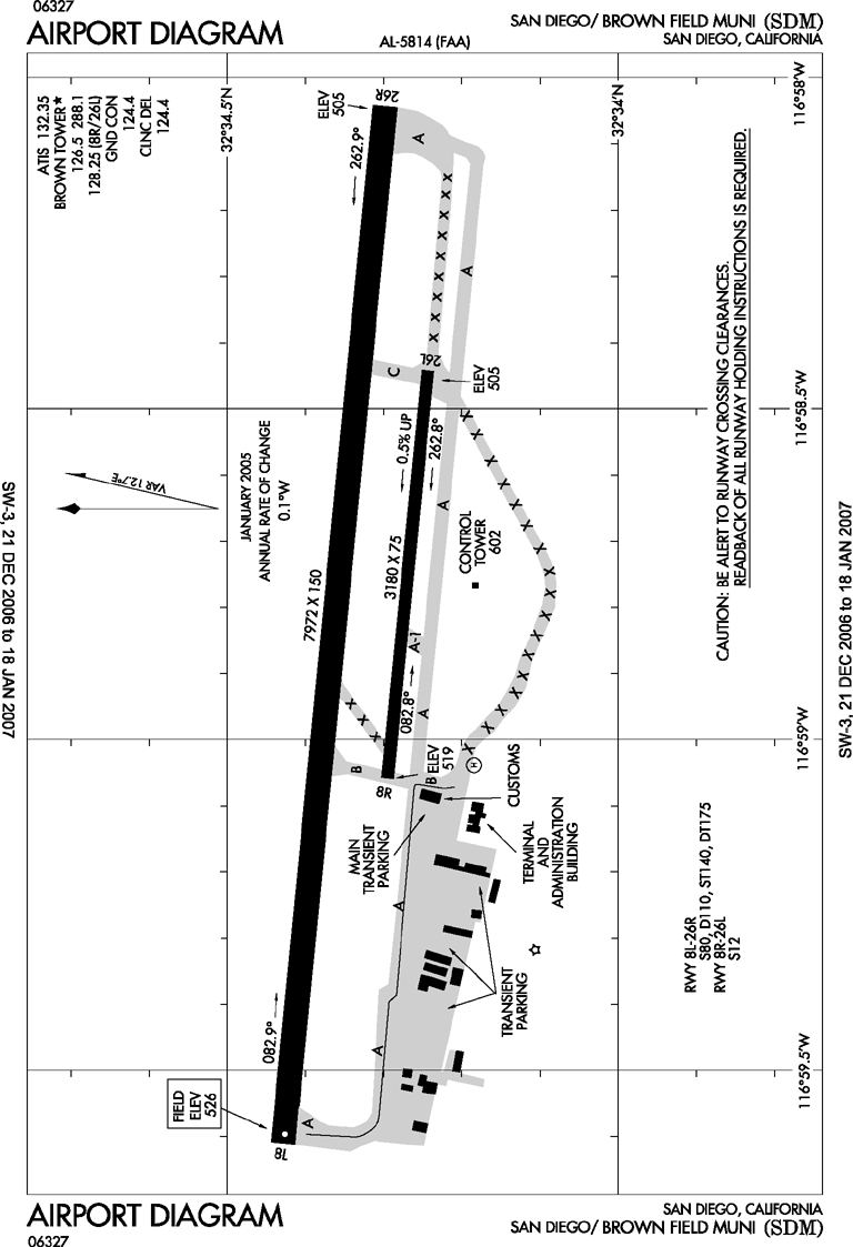
Airport diagram of Brown Field Municipal Airport in San Diego, California |
|---|---|
| Source | |
| Date |
December 13, 2006 |
| Author |
Federal Aviation Administration |
| Permission (Reusing this image) |
Work of the FAA - Public Domain |
| This image is a work of a Federal Aviation Administration employee, taken or made during the course of an employee's official duties. As works of the U.S. federal government, all FAA images are in the public domain. |  |
File history
Click on a date/time to view the file as it appeared at that time.
| Date/Time | Dimensions | User | Comment | |
|---|---|---|---|---|
| current | 21:09, 14 December 2006 | 768×1,123 (188 KB) | Epolk | ({{Information |Description=Airport diagram of Brown Field Municipal Airport in San Diego, California |Source=http://www.naco.faa.gov/ |Date=December 13, 2006 |Author=Federal Aviation Administration |Permission=Work of the FAA - Public Domain |other_versio) |
File links
The following pages on the English Wikipedia link to this file (pages on other projects are not listed):

