Image:Boston 1814.jpg
From Wikipedia, the free encyclopedia

Size of this preview: 656 × 600 pixels
Full resolution (1,580 × 1,444 pixels, file size: 573 KB, MIME type: image/jpeg)
| | This is a file from the Wikimedia Commons. The description on its description page there is shown below.
|
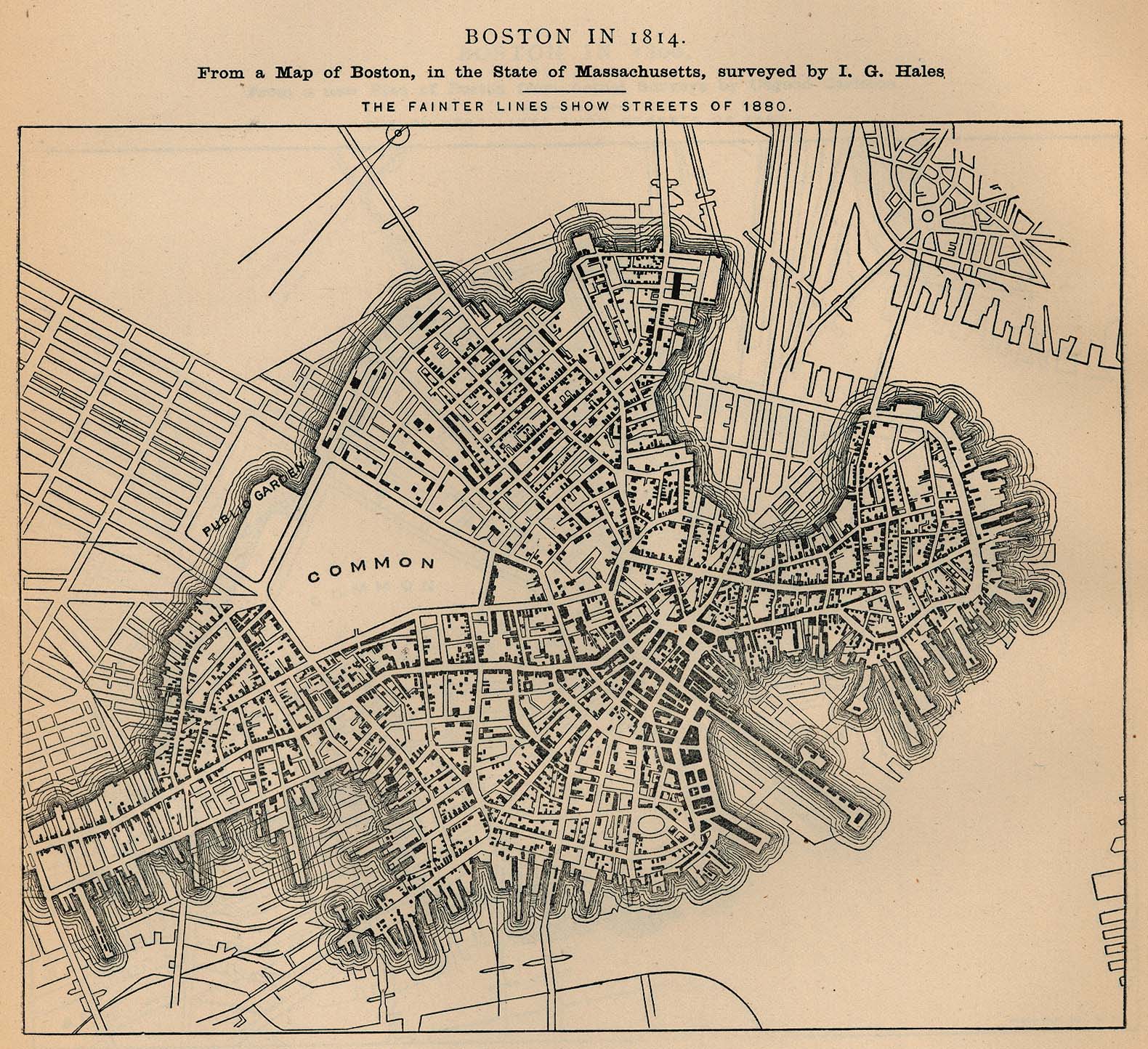
"Boston in 1814. From a map of Boston, in the State of Massachusetts, Surveyed by I.G. Hales" "The fainter lines show streets of 1880." From Report on the Social Statistics of Cities, Compiled by George E. Waring, Jr., United States. Census Office, Part I, 1886.
| This image or other media is a work of a United States Census Bureau employee, taken or made during the course of an employee's official duties. As a work of the U.S. federal government, the image is in the public domain |  |
Source: http://www.lib.utexas.edu/maps/historical/boston_1814.jpg
File history
Click on a date/time to view the file as it appeared at that time.
| Date/Time | Dimensions | User | Comment | |
|---|---|---|---|---|
| current | 03:42, 12 March 2007 | 1,580×1,444 (573 KB) | Beland | ("Boston in 1814. From a map of Boston, in the State of Massachusetts, Surveyed by I.G. Hales" "The fainter lines show streets of 1880." From Report on the Social Statistics of Cities, Compiled by George E. Waring, Jr., United States. Census Office, Part I) |
File links
No pages on the English Wikipedia link to this file. (Pages on other projects are not counted.)
Metadata
This file contains additional information, probably added from the digital camera or scanner used to create or digitize it. If the file has been modified from its original state, some details may not fully reflect the modified file.
| Orientation | Normal |
|---|---|
| Horizontal resolution | 200 dpi |
| Vertical resolution | 200 dpi |
| Software used | Adobe Photoshop 7.0 |
| File change date and time | 15:46, 4 September 2003 |
| Color space | 65535 |

