Image:Bostmtnterrain.jpg
From Wikipedia, the free encyclopedia
No higher resolution available.
Bostmtnterrain.jpg (800 × 406 pixels, file size: 307 KB, MIME type: image/jpeg)
[edit] Summary
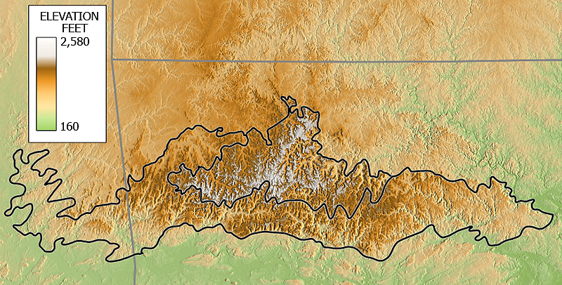
Elevation map of the Boston Mountains of Arkansas and Oklahoma based on Shuttle Radar Topography Mission (SRTM) 3 arcsecond digitial elevation model data.
[edit] Licensing
| I, the copyright holder of this work, hereby release it into the public domain. This applies worldwide. In case this is not legally possible, |
File history
Click on a date/time to view the file as it appeared at that time.
| Date/Time | Dimensions | User | Comment | |
|---|---|---|---|---|
| current | 04:46, 12 January 2007 | 800×406 (307 KB) | Tosborn (Talk | contribs) | (Elevation map of the Boston Mountains of Arkansas and Oklahoma based on Shuttle Radar Topography Mission (SRTM) 3 arcsecond digitial elevation model data. ) |
- Search for duplicate files
- Edit this file using an external application
See the setup instructions for more information.
File links
The following pages on the English Wikipedia link to this file (pages on other projects are not listed):
Metadata
This file contains additional information, probably added from the digital camera or scanner used to create or digitize it. If the file has been modified from its original state, some details may not fully reflect the modified file.
| Width | 974 |
|---|---|
| Height | 819 |
| Compression scheme | Uncompressed |
| Pixel composition | RGB |
| Orientation | Normal |
| Number of components | 3 |
| Horizontal resolution | 72 dpi |
| Vertical resolution | 72 dpi |
| Data arrangement | chunky format |
| Software used | Adobe Photoshop CS2 Windows |
| File change date and time | 23:35, 10 January 2007 |
| Color space | 65535 |

