Image:BlankMap-Europe-v2.png
From Wikipedia, the free encyclopedia
No higher resolution available.
BlankMap-Europe-v2.png (450 × 422 pixels, file size: 10 KB, MIME type: image/png)
| | This is a file from the Wikimedia Commons. The description on its description page there is shown below.
|
[edit] Summary
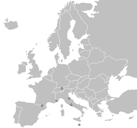
map from wikipedia, "A blank map of Europe as of 2005, with country outlines. Sovereign microstates less than 2 500 km² in area are depicted as circles."
[edit] Licensing
 |
Permission is granted to copy, distribute and/or modify this document under the terms of the GNU Free Documentation License, Version 1.2 or any later version published by the Free Software Foundation; with no Invariant Sections, no Front-Cover Texts, and no Back-Cover Texts. Subject to disclaimers. Asturianu | Български | Català | Deutsch | English | Español | Français | Gaeilge | Italiano | 한국어 | 日本語 | Polski | Português | Română | Türkçe | +/- |
File history
Click on a date/time to view the file as it appeared at that time.
| Date/Time | Dimensions | User | Comment | |
|---|---|---|---|---|
| current | 13:31, 12 June 2008 | 450×422 (10 KB) | Milosevo | (Reverted to version as of 19:32, 9 June 2008) |
| 11:25, 12 June 2008 | 450×422 (15 KB) | Cradel | (+KOS) | |
| 19:32, 9 June 2008 | 450×422 (10 KB) | Milosevo | (Reverted to version as of 19:36, 19 March 2008 vandalism, kosovo is no un-member) | |
| 21:58, 22 March 2008 | 450×422 (15 KB) | Nightstallion | (Reverted to version as of 16:35, 13 March 2008) | |
| 19:36, 19 March 2008 | 450×422 (10 KB) | Patstuart | (Reverted to version as of 18:17, 11 March 2008 - see Image talk:BlankMap-World-v6.png#As stated in reversion) | |
| 16:35, 13 March 2008 | 450×422 (15 KB) | Nightstallion | (upload a variant if you wish, but the majority in Europe recognises or will recognise.) | |
| 18:17, 11 March 2008 | 450×422 (10 KB) | Avala | (there must be consensus in Europe to show this as a final border) | |
| 02:41, 24 February 2008 | 450×422 (15 KB) | Hoshie | (Added Kosovo since it has been internationally recognized) | |
| 02:14, 10 October 2006 | 450×422 (10 KB) | Cogito ergo sumo | (Map: Europe, w/circled microstates) | |
| 05:57, 26 June 2006 | 450×422 (10 KB) | Roke | (map from wikipedia, "A blank map of Europe as of 2005, with country outlines. Sovereign microstates less than 2 500 km² in area are depicted as circles." Maps of Europe Blank maps) |
File links
The following pages on the English Wikipedia link to this file (pages on other projects are not listed):

