Image:Beltway sniper map.gif
From Wikipedia, the free encyclopedia
No higher resolution available.
Beltway_sniper_map.gif (463 × 558 pixels, file size: 22 KB, MIME type: image/gif)
| | This is a file from the Wikimedia Commons. The description on its description page there is shown below.
|
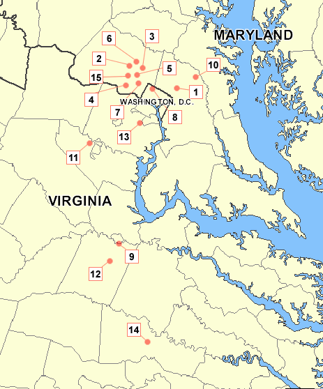
Map I made using an existing map of the area from http://www.nationalatlas.gov. Numbering references [1].

File history
Click on a date/time to view the file as it appeared at that time.
| Date/Time | Dimensions | User | Comment | |
|---|---|---|---|---|
| current | 01:38, 27 October 2005 | 463×558 (22 KB) | Tom | (adding names of states) |
| 03:58, 26 April 2005 | 463×558 (18 KB) | Tom | ||
| 03:56, 26 April 2005 | 714×558 (24 KB) | Tom | (Map I made using a map of the area from http://www.nationalatlas.gov {{GFDL}}) |
File links
The following pages on the English Wikipedia link to this file (pages on other projects are not listed):

