Image:BakerIsland.jpeg
From Wikipedia, the free encyclopedia

No higher resolution available.
BakerIsland.jpeg (384 × 288 pixels, file size: 26 KB, MIME type: image/jpeg)
| | This is a file from the Wikimedia Commons. The description on its description page there is shown below.
|
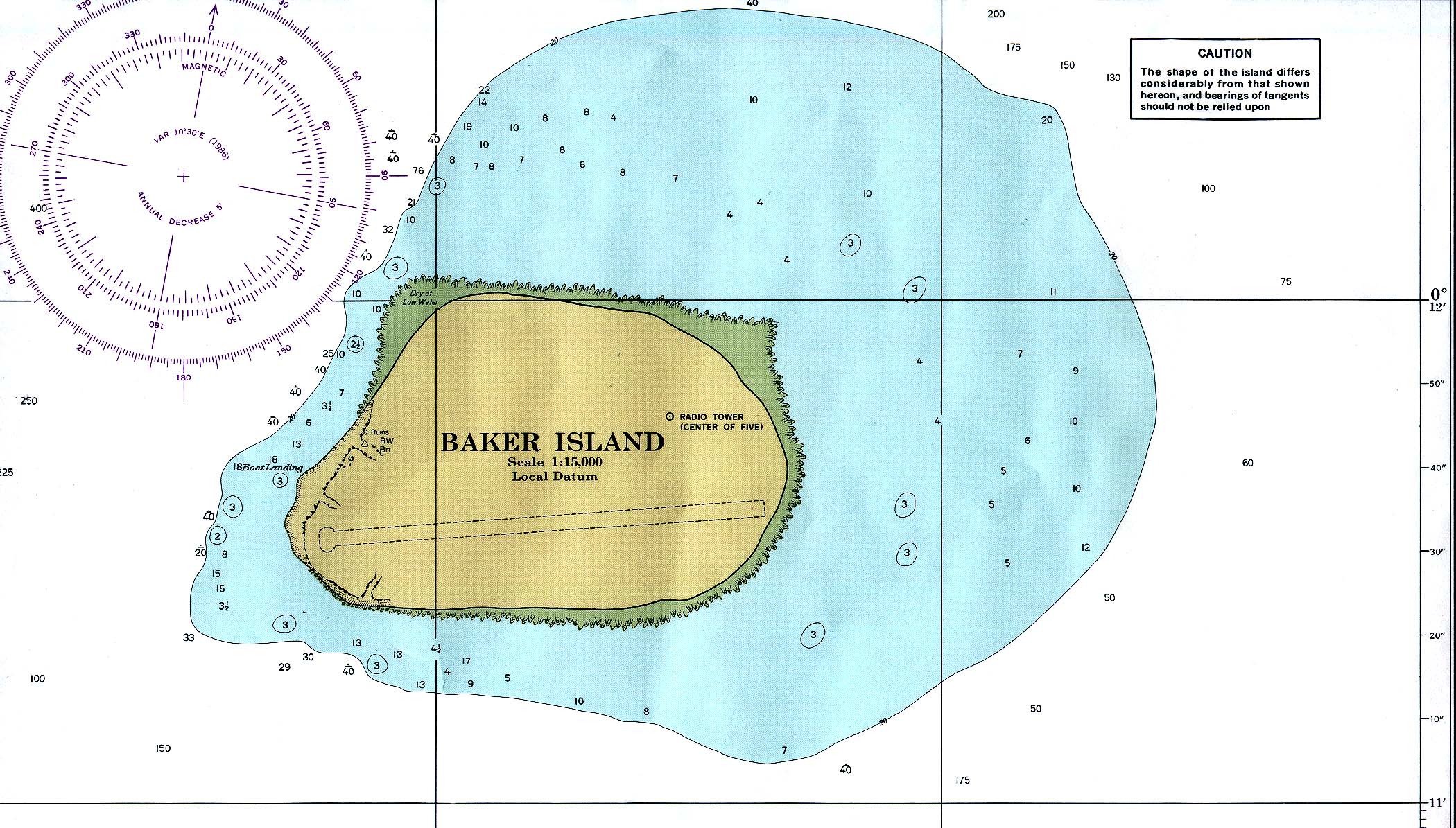
Baker Island
Modified from PCL map collection
- Baker_island_86.jpg. Nautical chart, original 1:15000 produced by NOAA, 1978. Subsequent revision: 1986.
| This work is in the public domain in the United States because it is a work of the United States Federal Government under the terms of Title 17, Chapter 1, Section 105 of the US Code. See Copyright.
Note: This only applies to works of the Federal Government and not to the work of any individual U.S. state, territory, commonwealth, county, municipality, or any other subdivision. العربية | Български | Česky | Deutsch | English | Español | Français | Magyar | Italiano | 日本語 | 한국어 | Polski | Português | 中文(繁體) | 中文(简体) | +/- |
 |
 A vector version of this image (SVG) is available. For more information about vector graphics, read about Commons transition to SVG. Български | Deutsch | English | Español | Français | Galego | עברית | Magyar | Bahasa Indonesia | Italiano | 日本語 | 한국어 | Lietuvių | Polski | Português | Русский | Српски / Srpski | Українська | 中文(简体) | 中文(繁體) | +/- |
 |
File history
Click on a date/time to view the file as it appeared at that time.
| Date/Time | Dimensions | User | Comment | |
|---|---|---|---|---|
| current | 21:41, 25 November 2006 | 384×288 (26 KB) | Electionworld | (Baker Island Modified from [http://www.lib.utexas.edu/maps/index.html PCL map collection] * [http://www.lib.utexas.edu/maps/islands_oceans_poles/baker_island_86.jpg Baker_island_86.jpg]. Nautical chart, original 1:15000 produced by NOAA, 1978. Subsequen) |

