Image:Bacan Topography.png
From Wikipedia, the free encyclopedia
Size of this preview: 800 × 579 pixels
Full resolution (1,785 × 1,291 pixels, file size: 1.16 MB, MIME type: image/png)
| | This is a file from the Wikimedia Commons. The description on its description page there is shown below.
|
[edit] Summary
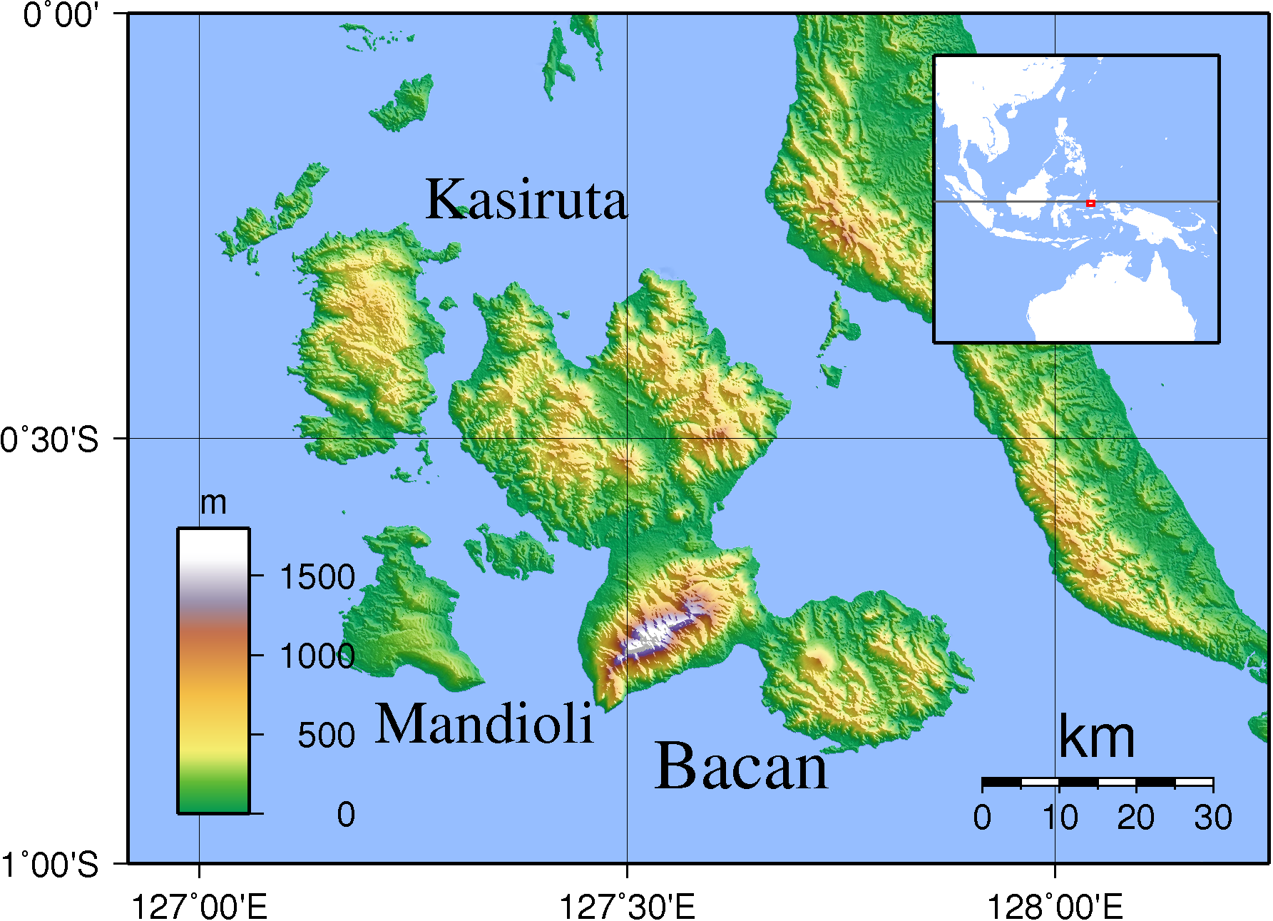
| Description |
Topographic map of Bacan and other nearby islands. Created with GMT from SRTM data. |
|---|---|
| Source |
self-made |
| Date |
Sep 16, 2007 |
| Author | |
| Permission (Reusing this image) |
see below |
[edit] Licensing

File history
Click on a date/time to view the file as it appeared at that time.
| Date/Time | Dimensions | User | Comment | |
|---|---|---|---|---|
| current | 16:16, 16 September 2007 | 1,785×1,291 (1.16 MB) | Sadalmelik | ({{Information |Description=Topographic map of Bacan and other nearby islands. Created with GMT from SRTM data. |Source=self-made |Date=Sep 16, 2007 |Author= Sadalmelik }} Category:Maps of Indonesia [[Category:Topographic maps of A) |
File links
The following pages on the English Wikipedia link to this file (pages on other projects are not listed):

