Image:Austria-Hungary post-division, William Shepherd 1926 atlas.jpg
From Wikipedia, the free encyclopedia

Size of this preview: 784 × 599 pixels
Full resolution (1,525 × 1,166 pixels, file size: 626 KB, MIME type: image/jpeg)
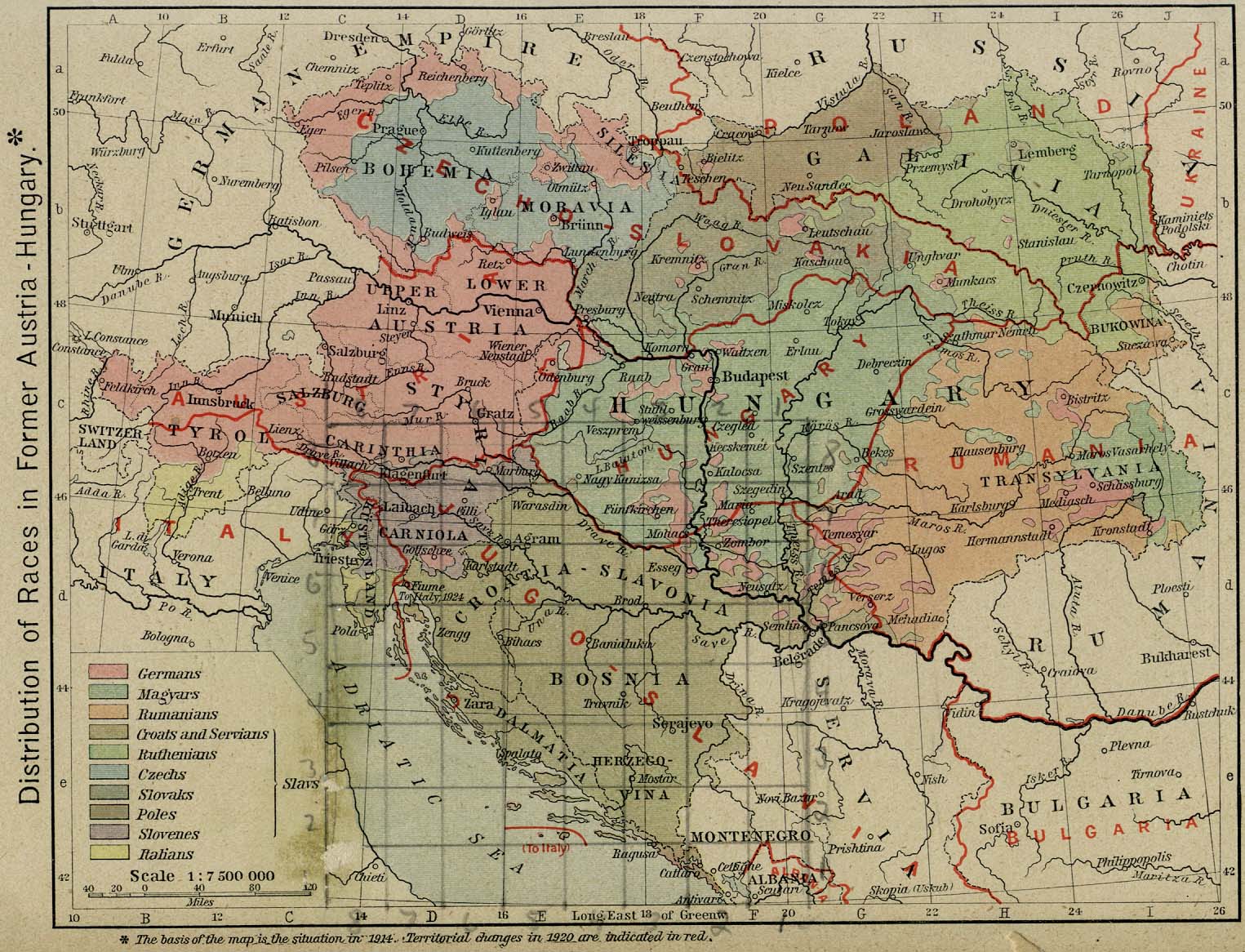
Map of distribution of races (by language) of Austria-Hungary with the lines marking the divisions that created the new central and eastern european countries after World War I.
The original map came from the Perry-Castañeda Library Map Collection at the University of Texas at Austin.
[edit] Licensing
| This image is in the public domain because its copyright has expired in the United States and those countries with a copyright term of no more than the life of the author plus 100 years. |
File history
Click on a date/time to view the file as it appeared at that time.
| Date/Time | Dimensions | User | Comment | |
|---|---|---|---|---|
| current | 05:12, 27 May 2008 | 1,525×1,166 (626 KB) | MaGioZal (Talk | contribs) | (Map of distribution of races (by language) of Austria-Hungary with the lines marking the divisions that created the new central and eastern european countries after World War I. The [http://www.lib.utexas.edu/maps/historical/shepherd/austria_hun) |
- Search for duplicate files
- Edit this file using an external application
See the setup instructions for more information.
File links
The following pages on the English Wikipedia link to this file (pages on other projects are not listed):

