Image:Auckland20061016222837.jpg
From Wikipedia, the free encyclopedia
Size of this preview: 674 × 600 pixels
Full resolution (1,200 × 1,068 pixels, file size: 224 KB, MIME type: image/jpeg)
| | This is a file from the Wikimedia Commons. The description on its description page there is shown below.
|
[edit] Summary
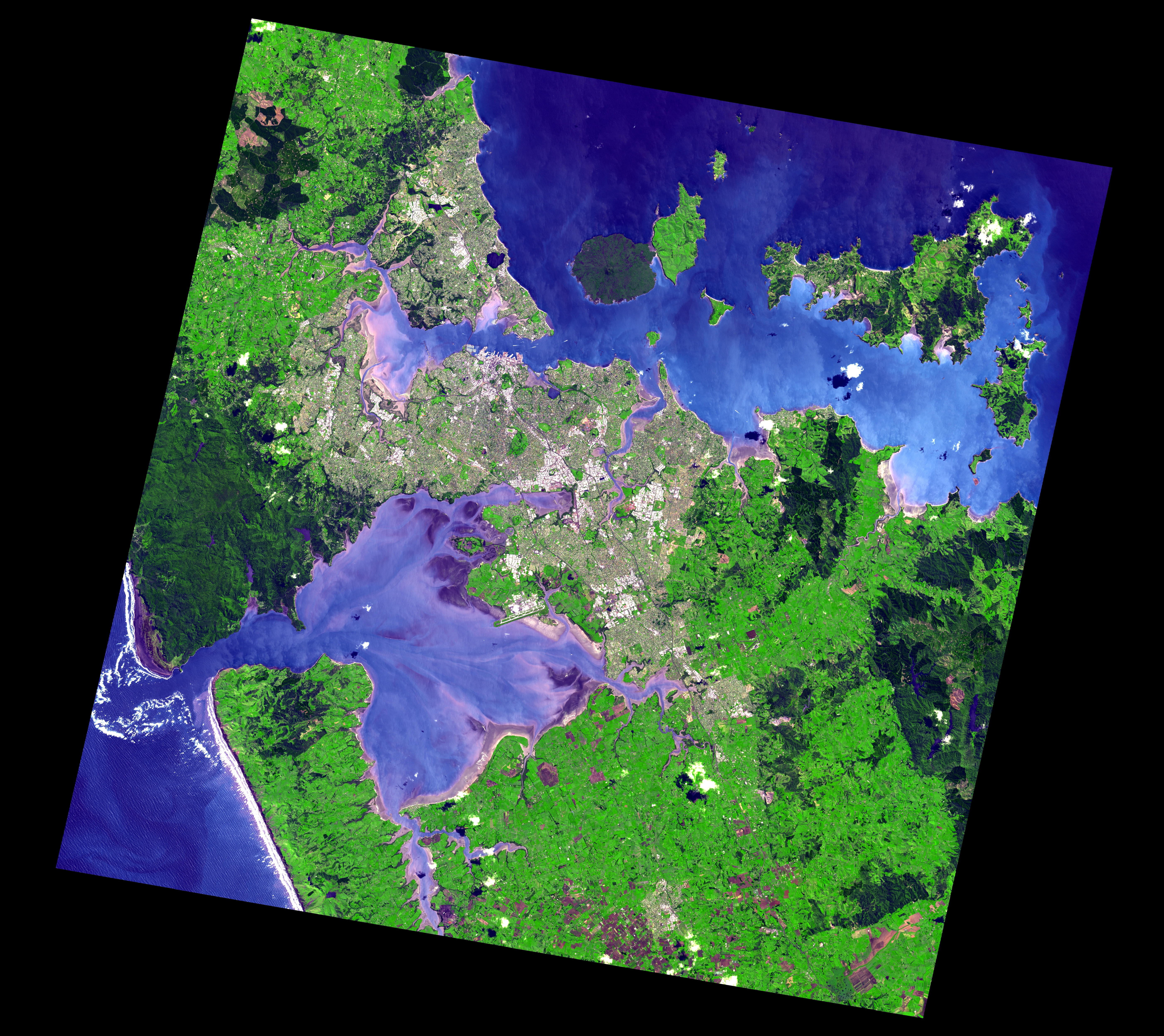
Satellite image of Auckland, New Zealand, and the islands of the inner Hauraki Gulf.
Corner points:
- Image width = 5599 height = 4983 bands = 3
Geo Projection
- Top Left -36.611691 174.364053
- Lat Increment 0.0001350000 Long Increment 0.0001689228
Full Image:-
- UL = -36.611691 174.364053 UR = -36.611691 175.309683
- LL = -37.284261 174.364053 LR = -37.284261 175.309683
Actual Image:-
- Image_UL = -36.623571 174.567099 Image_UR = -36.720366 175.267959
- Image_LL = -37.175316 174.409325 Image_LR = -37.272651 175.115253
- Image_UL_Loc = 1202 88 Image_UR_Loc = 5351 805
- Image_LL_Loc = 268 4175 Image_LR_Loc = 4447 4896
Source: http://ava.jpl.nasa.gov/public/2006/10/16/20061016222837-1200x1200.jpg, listed on this page in the ASTER Volcano Archive.
Larger version stored in this image's history was downloaded from http://ava.jpl.nasa.gov/public/2006/10/16/20061016222837.jpg.
[edit] Licensing
|
|
This file is in the public domain because it was created by NASA. NASA copyright policy states that "NASA material is not protected by copyright unless noted". (NASA copyright policy page or JPL Image Use Policy).
Deutsch | English | Español | Français | Nederlands | Português | Русский | 中文(简体) | 中文(繁體) | +/- |
|
 |
Warnings:
|
File history
Click on a date/time to view the file as it appeared at that time.
| Date/Time | Dimensions | User | Comment | |
|---|---|---|---|---|
| current | 09:25, 8 September 2007 | 1,200×1,068 (224 KB) | Avenue | (Satellite image of Auckland, New Zealand, and the islands of the inner Hauraki Gulf. Data Acquired: 2006-10-16 Corner points: * Image width = 5599 height = 4983 bands = 3 Geo Projection * Top Left -36.611691 174.364053 * Lat Increment 0.0001350000 L) |
| 09:18, 8 September 2007 | 5,599×4,983 (5.44 MB) | Avenue | (Satellite image of Auckland, New Zealand, and the islands of the inner Hauraki Gulf. Data Acquired: 2006-10-16 Corner points: Image width = 5599 height = 4983 bands = 3 Geo Projection Top Left -36.611691 174.364053 Lat Increment 0.0001350000 Long ) |
File links
The following pages on the English Wikipedia link to this file (pages on other projects are not listed):

