Image:Arches National Park Map.jpg
From Wikipedia, the free encyclopedia
Size of this preview: 400 × 600 pixels
Full resolution (2,500 × 3,750 pixels, file size: 3.52 MB, MIME type: image/jpeg)
| | This is a file from the Wikimedia Commons. The description on its description page there is shown below.
|
| This is a featured picture at the English Wikipedia project. The nomination can be found here. If you think it should be featured on the Commons as well or have an image of similar quality that can be published under a suitable copyright license, be sure to upload it, tag it, and nominate it. |
[edit] Summary
| Description |
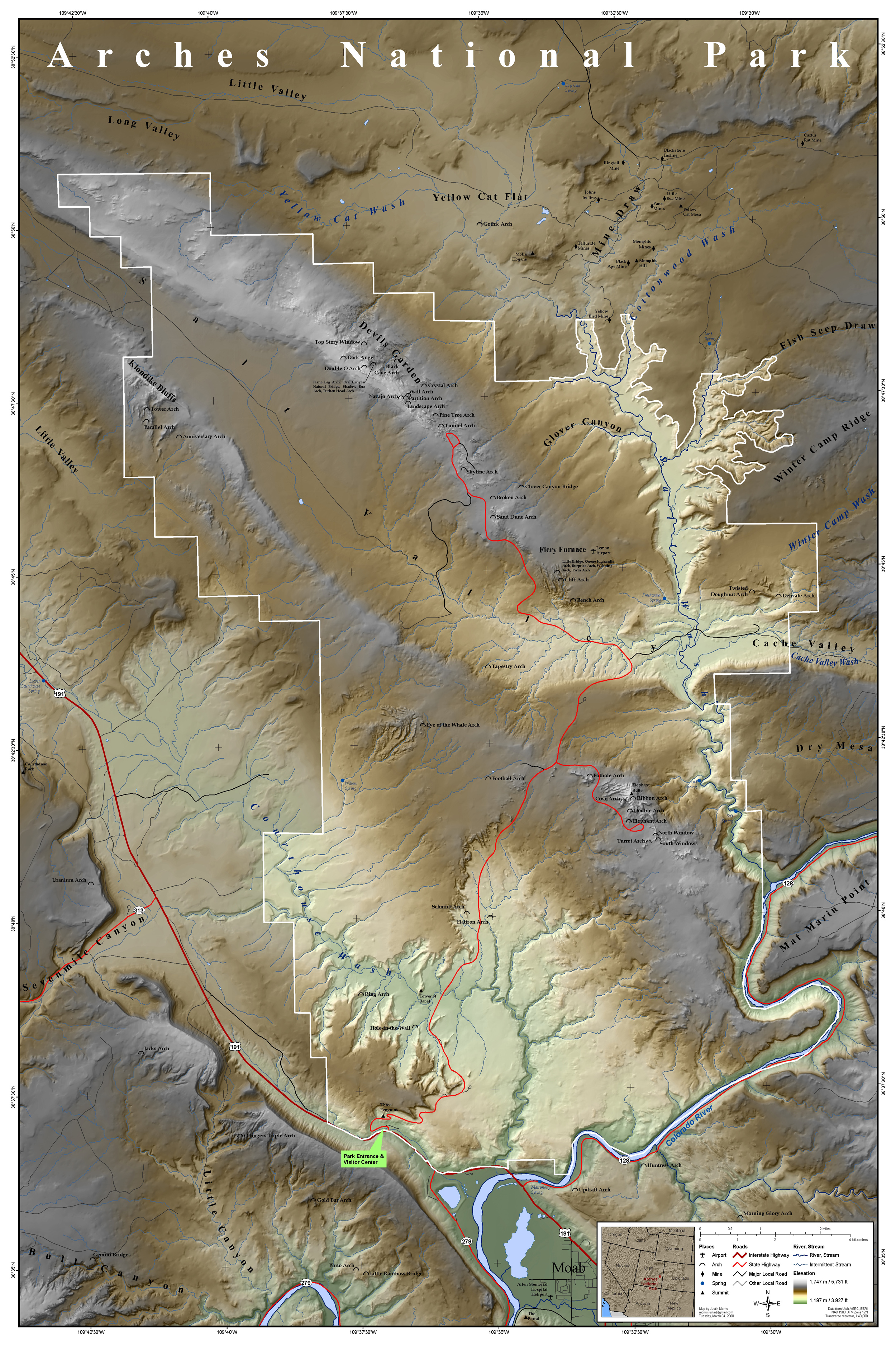
Map of Arches National Park, Utah, United States showing predominant features such as arches, peaks, rivers and streams, mines, and roads. |
|||||
|---|---|---|---|---|---|---|
| Source |
This map was entirely self made using ArcGIS. Map data is from Utah AGRC, ESRI and the USGS. |
|||||
| Date |
Sunday, March 2, 2008 |
|||||
| Author | ||||||
| Permission (Reusing this image) |
|
File history
Click on a date/time to view the file as it appeared at that time.
| Date/Time | Dimensions | User | Comment | |
|---|---|---|---|---|
| current | 17:15, 16 March 2008 | 2,500×3,750 (3.52 MB) | Justinmorris | ({{FeaturedPicture|Arches National Park Map}} == Summary == {{Information |Description=Map of Arches National Park, Utah, United States showing predominant features such as arches, peaks, rivers and streams, mines, and roads. |S) |
File links
- Arches National Park
- Wikipedia:Featured pictures
- Portal:Utah
- Portal:Utah/Featured content
- User talk:Justinmorris
- Wikipedia:Picture peer review/Archives/Jan-Mar 2008
- Wikipedia:Featured pictures thumbs 12
- Wikipedia:Featured picture candidates/March-2008
- Wikipedia:Picture peer review/Arches National Park Map
- User:Justinmorris
- Wikipedia:Featured picture candidates/Arches National Park Map
- Wikipedia:Wikipedia Signpost/2008-03-17/Features and admins
- User:Justinmorris/Maps
- Wikipedia:Featured pictures/Diagrams, drawings, and maps/Maps
Metadata
This file contains additional information, probably added from the digital camera or scanner used to create or digitize it. If the file has been modified from its original state, some details may not fully reflect the modified file.
| Orientation | Normal |
|---|---|
| Horizontal resolution | 150 dpi |
| Vertical resolution | 150 dpi |
| Software used | Adobe Photoshop CS3 Macintosh |
| File change date and time | 19:03, 5 March 2008 |
| Color space | 65535 |

