Image:Aqua rwanda 05jun04 250m.jpg
From Wikipedia, the free encyclopedia
Size of this preview: 598 × 599 pixels
Full resolution (1,772 × 1,776 pixels, file size: 3.15 MB, MIME type: image/jpeg)
| | This is a file from the Wikimedia Commons. The description on its description page there is shown below.
|
| Description |
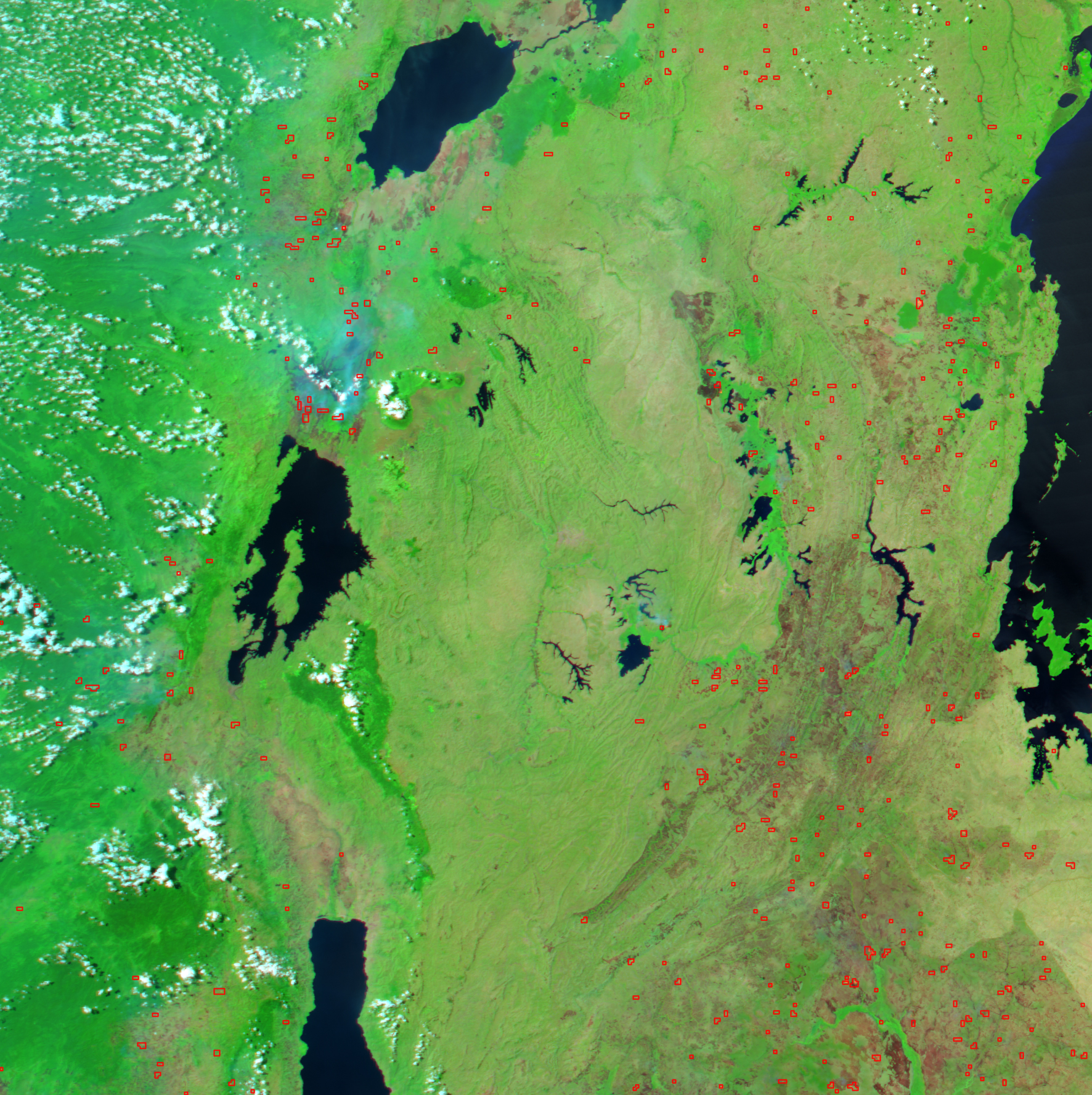
Original caption states, "In east-central Africa, numerous fires (marked in yellow), probably agricultural in purpose, were burning when the Moderate Resolution Imaging Spectroradiometer (MODIS) on NASA’s Aqua satellite captured this image on July 5, 2004. Unfortunately, in the Kagera National Park that hugs the far eastern margin of Rwanda, the fires may not be routine agricultural burning. According to news reports, wildfires started by poachers may have burned as much as one-third of the protected land in the park. The dense vegetation (bright green) of the small park (seen in rectangular inset) is marred by several reddish-brown burn scars, the largest in the northern tip of the park, surrounded by three actively burning fires. Water in the image appears dark blue or nearly black." |
|||||
|---|---|---|---|---|---|---|
| Source | ||||||
| Date |
Image posted July 09, 2004 |
|||||
| Author |
Jesse Allen, using NASA’s Aqua satellite's Moderate Resolution Imaging Spectroradiometer (MODIS) for the MODIS Rapid Response Team, NASA-GSFC |
|||||
| Permission (Reusing this image) |
|
|||||
| Other versions | Image:Aqua_rwanda_05jun04.jpg for smaller version with inset of Akagera National Park |

File history
Click on a date/time to view the file as it appeared at that time.
| Date/Time | Dimensions | User | Comment | |
|---|---|---|---|---|
| current | 07:10, 27 June 2007 | 1,772×1,776 (3.15 MB) | BanyanTree | ({{Information |Description= Original caption states, "In east-central Africa, numerous fires (marked in yellow), probably agricultural in purpose, were burning when the Moderate Resolution Imaging Spectroradiometer (MODIS) on NASA’s Aqua satellite captu) |
File links
Metadata
This file contains additional information, probably added from the digital camera or scanner used to create or digitize it. If the file has been modified from its original state, some details may not fully reflect the modified file.
| Image title | IDL TIFF file |
|---|---|
| Orientation | Normal |
| Horizontal resolution | 100 dpi |
| Vertical resolution | 100 dpi |
| Software used | Adobe Photoshop CS Macintosh |
| File change date and time | 12:04, 9 July 2004 |
| Color space | 65535 |

