Image:Antarctic Ice Melt-First Year.jpg
From Wikipedia, the free encyclopedia
Size of this preview: 581 × 599 pixels
Full resolution (732 × 755 pixels, file size: 63 KB, MIME type: image/jpeg)
| | This is a file from the Wikimedia Commons. The description on its description page there is shown below.
|
[edit] Summary
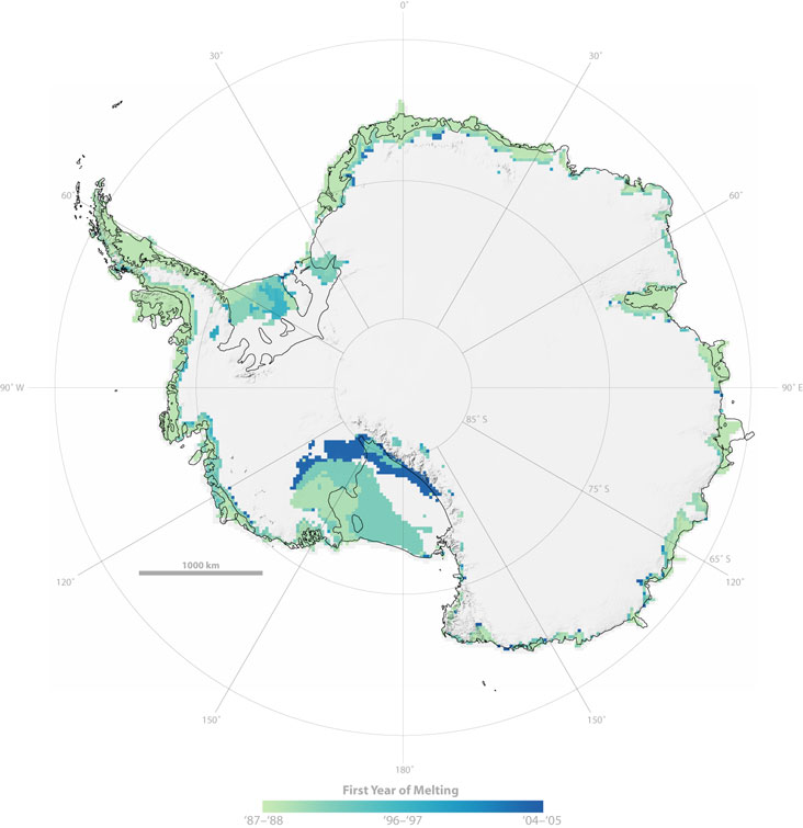
A map of Antarctica indicates first time persistent melting detected within the study period from 1987-2006. Areas where persistent melting took place are shown in darker shades of green
| Description |
Image showing Antarctic snowmelt in various areas for the first time |
|---|---|
| Source |
http://www.nasa.gov/centers/goddard/images/content/189831main_antarctica_1styr_lg.jpg |
| Date | |
| Author |
NASA/Rob Simmon |
| Permission (Reusing this image) |
see below |
[edit] Licensing
|
|
This file is in the public domain because it was created by NASA. NASA copyright policy states that "NASA material is not protected by copyright unless noted". (NASA copyright policy page or JPL Image Use Policy).
Deutsch | English | Español | Français | Nederlands | Português | Русский | 中文(简体) | 中文(繁體) | +/- |
|
 |
Warnings:
|
File history
Click on a date/time to view the file as it appeared at that time.
| Date/Time | Dimensions | User | Comment | |
|---|---|---|---|---|
| current | 06:09, 6 November 2007 | 732×755 (63 KB) | Sagredo | ({{Information |Description= |Source=http://www.nasa.gov/centers/goddard/images/content/189831main_antarctica_1styr_lg.jpg |Date= |Author= |Permission= |other_versions= }} ) |
File links
The following pages on the English Wikipedia link to this file (pages on other projects are not listed):

