Image:AmsterdamIsl Map.png
From Wikipedia, the free encyclopedia
Size of this preview: 536 × 600 pixels
Full resolution (1,887 × 2,112 pixels, file size: 1.05 MB, MIME type: image/png)
| | This is a file from the Wikimedia Commons. The description on its description page there is shown below.
|
[edit] Summary
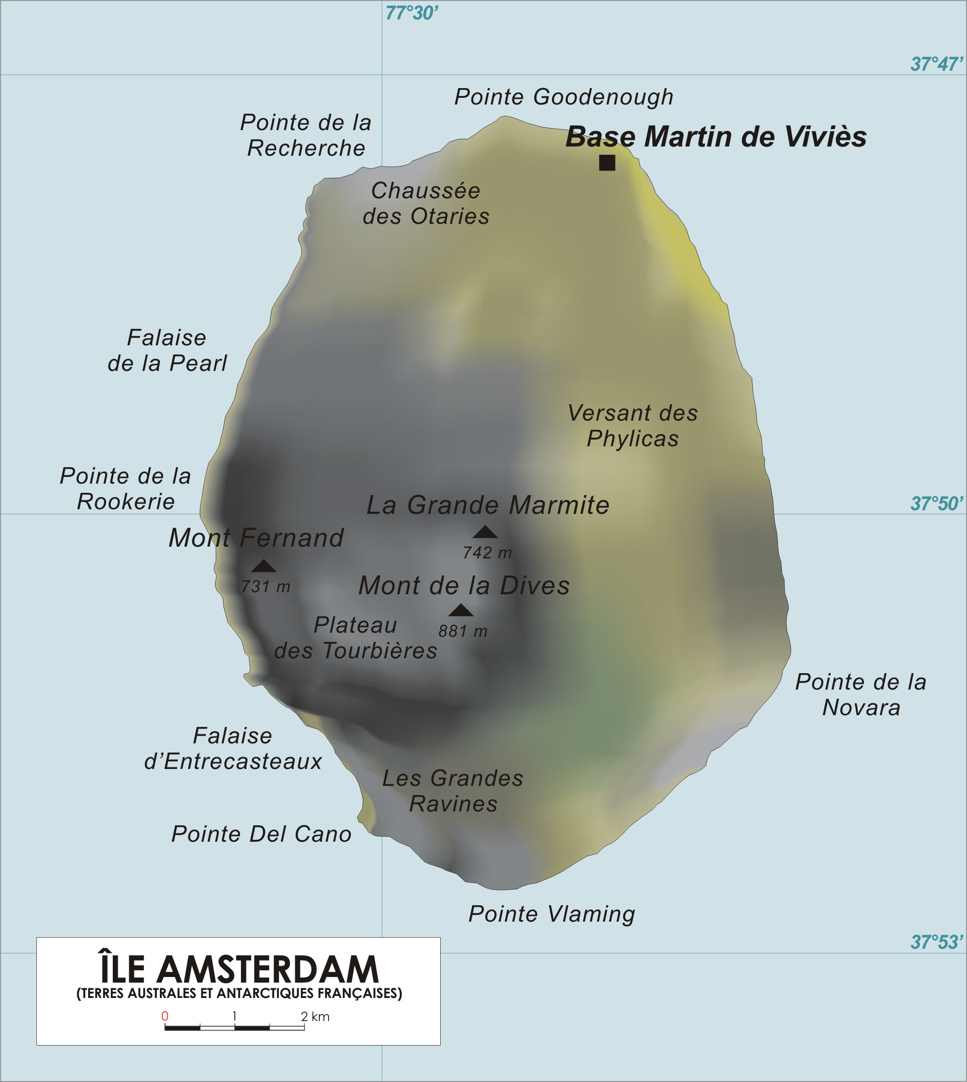
| Description |
English: Map of Amsterdam Island, French Southern and Antarctic Territories.
Français : Carte de l'Ile Amsterdam, Terres australes et antarctiques françaises.
|
||
|---|---|---|---|
| Source |
Original drawing |
||
| Date | |||
| Author | |||
| Permission (Reusing this image) |
|
File history
Click on a date/time to view the file as it appeared at that time.
| Date/Time | Dimensions | User | Comment | |
|---|---|---|---|---|
| current | 14:05, 27 April 2006 | 1,887×2,112 (1.05 MB) | Varp | |
| 13:50, 26 April 2006 | 1,887×1,965 (1.01 MB) | Varp | (*Map of Amsterdam Island, French Southern and Antarctic Territories *drawn by varp) |

