Image:Algeria provinces numbered.png
From Wikipedia, the free encyclopedia
Size of this preview: 444 × 599 pixels
Full resolution (500 × 675 pixels, file size: 26 KB, MIME type: image/png)
| | This is a file from the Wikimedia Commons. The description on its description page there is shown below.
|
 |
This map image should be recreated using vector graphics as an SVG file. This has several advantages; see Commons:Media for cleanup for more information. If an SVG form of this image is already available, please upload it. After uploading an SVG, replace this template with template {{Vector version available|new image name.svg}} in this image. |
|
العربية | Български | Català | Česky | Dansk | Deutsch | English | Esperanto | Español | Français | 한국어 | Italiano | Magyar | Lietuvių | Nederlands | 日本語 | Polski | Português | Română | Русский | Suomi | Svenska | Türkçe | Українська | Tiếng Việt | मराठी | 中文(繁體) | 中文(简体) | +/- |
|
| Description |
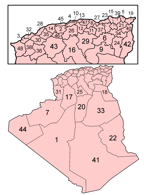
Map of the provinces of Algeria, numbered in English alphabetical order.
|
|---|---|
| Source |
Self-made, traced from public domain UN or CIA maps. |
| Date |
December 2005 |
| Author | |
| Permission (Reusing this image) |
Provide attribution, please. See below. |

File history
Click on a date/time to view the file as it appeared at that time.
| Date/Time | Dimensions | User | Comment | |
|---|---|---|---|---|
| current | 03:46, 20 September 2006 | 500×675 (26 KB) | Golbez | ({{Information |Description=Map of the provinces of Algeria, numbered in English alphabetical order. # Adrar # Ain Defla # Ain Temouchent # [[:Image:Algeria) |
File links
The following pages on the English Wikipedia link to this file (pages on other projects are not listed):

