Image:Alexandria Winchester 1776.jpg
From Wikipedia, the free encyclopedia
Size of this preview: 800 × 466 pixels
Full resolution (1,208 × 704 pixels, file size: 247 KB, MIME type: image/jpeg)
| | This is a file from the Wikimedia Commons. The description on its description page there is shown below.
|
| This image (or other media file) is in the public domain because its copyright has expired. This applies to the United States, Canada, the European Union and those countries with a copyright term of life of the author plus 70 years.
العربية | Asturianu | Български | Català | Česky | Dansk | Deutsch | English | Ελληνικά | Esperanto | Español | Euskara | فارسی | Français | Gaeilge | Galego | עברית | हिन्दी | Bahasa Indonesia | Italiano | 日本語 | 한국어 | Kurdî / كوردی | Lietuvių | Magyar | Nederlands | Norsk (nynorsk) | Bahasa Melayu | Polski | Português | Română | Русский | Slovenčina | Slovenščina | Shqip | Suomi | Sámegiella | Türkçe | 中文(简体) | 中文(繁體) | 粵語 | +/- |
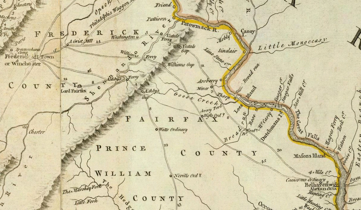
This is a portion of a map:
- Author: Jefferys, Thomas
- Date: 1776
- Title: A Map of the most Inhabited part of Virginia containing the whole province of Maryland with Part of Pensilvania, New Jersey and North Carolina. Drawn by Joshua Fry & Peter Jefferson in 1775.
- Publisher: London: Sayer and Bennett
- Published in: The American Atlas: Or, A Geographical Description Of The Whole Continent Of America
File history
Click on a date/time to view the file as it appeared at that time.
| Date/Time | Dimensions | User | Comment | |
|---|---|---|---|---|
| current | 01:09, 4 July 2007 | 1,208×704 (247 KB) | NE2 | ({{PD-old}} This is a portion of [http://www.davidrumsey.com/maps4596.html a map]: *Author: Jefferys, Thomas *Date: 1776 *Title: A Map of the most Inhabited part of Virginia containing the whole province of Maryland with Part of Pensilvania, New Jersey and) |

