Image:Alexander-Empire 323bc.jpg
From Wikipedia, the free encyclopedia
Size of this preview: 800 × 444 pixels
Full resolution (2,321 × 1,288 pixels, file size: 933 KB, MIME type: image/jpeg)
| | This is a file from the Wikimedia Commons. The description on its description page there is shown below.
|
| Description |
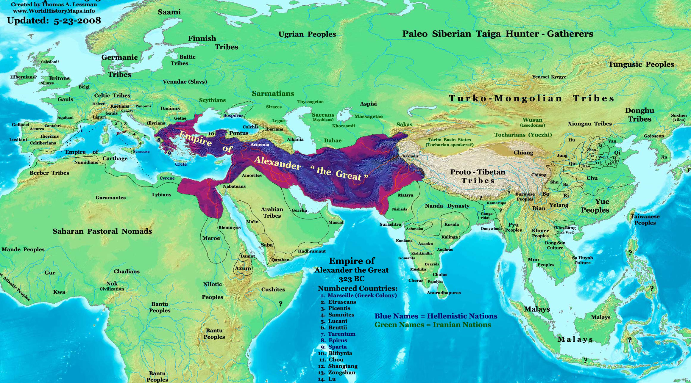
The Empire of Alexander the Great in 323 BC. |
|||
|---|---|---|---|---|
| Source |
Self-made |
|||
| Date |
1-30-2008 |
|||
| Author | ||||
| Permission (Reusing this image) |
|
|||
| Other versions | see below |
Contents |
[edit] Map Summary

Original Source URL: http://www.thomaslessman.com/History/images/East-Hem_001ad.jpg
This map is a zoomed-in version of Thomas Lessman's map of the East-Hem_323bc.jpg (also available at www.WorldHistoryMaps.info).
The highlighted areas represent the Empire of Alexander the Great at his death in 323 BC.
[edit] Map Source References
Remember, sources often conflict with each other. This map is only as accurate as the information that is available to me. To report any errors or to help further this work, please click here, or email Thomas Lessman at talessman@yis.us
References for information contained in this map:
[edit] Other Maps by Thomas Lessman
| World History Maps showing history of the World or Eastern Hemisphere.
Bold dates are available on Wikimedia or Wikipedia. |
||
| Primeval | ||
| Ancient
|
·| 600 BC | 550 BC | 527 BC | 500 BC | 400 BC | ·| 001 AD | 050 AD | 100 AD | 200 AD | 300 AD | |
|
| Medieval |
·| 500 AD | 525 AD | 565 AD | 600 AD | 700 AD | |
|
| Modern |
·| 1500 AD | · * For more maps after 1500 AD (and before), |
|
| (This template: · view · discuss ) | ||
[edit] Other Info
[edit] Licensing:
|
File history
Click on a date/time to view the file as it appeared at that time.
| Date/Time | Dimensions | User | Comment | |
|---|---|---|---|---|
| current | 14:02, 23 May 2008 | 2,321×1,288 (933 KB) | Talessman | (|Author= Talessman Category:Alexander the Great Category:Hellenistic age Category:Maps of Hellenistic States) |

