Image:Alba Patera - topography map.png
From Wikipedia, the free encyclopedia
Size of this preview: 601 × 599 pixels
Full resolution (623 × 621 pixels, file size: 395 KB, MIME type: image/png)
| | This is a file from the Wikimedia Commons. The description on its description page there is shown below.
|
| Description |
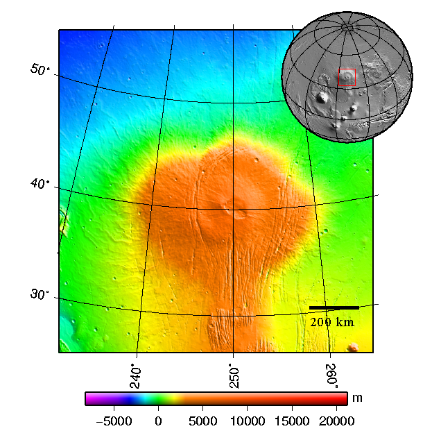
Česky: Štítová sopka Alba Patera na Marsu - topografická mapa
English: Topography map of shield vulcano Alba Patera on Mars
|
|---|---|
| Source |
plotted using GMT and gridded MOLA data archive meg0031t.grd |
| Date |
2008-03-see below |
| Author | |
| Permission (Reusing this image) |
|

File history
Click on a date/time to view the file as it appeared at that time.
| Date/Time | Dimensions | User | Comment | |
|---|---|---|---|---|
| current | 22:48, 10 March 2008 | 623×621 (395 KB) | Chmee2 | ({{Information |Description={{cs|Štítová sopka Alba Patera na Marsu - topografická mapa}} {{en|Topography map of shield vulcano Alba Patera on Mars}} |Source=plotted using GMT and gridded MOLA data archive meg0031t.grd |Date=2008-03-see below |Author=[) |
File links
The following pages on the English Wikipedia link to this file (pages on other projects are not listed):

