Image:Afghanistan provinces 1996-2004.png
From Wikipedia, the free encyclopedia
Size of this preview: 781 × 600 pixels
Full resolution (1,000 × 768 pixels, file size: 38 KB, MIME type: image/png)
| | This is a file from the Wikimedia Commons. The description on its description page there is shown below.
|
[edit] Summary
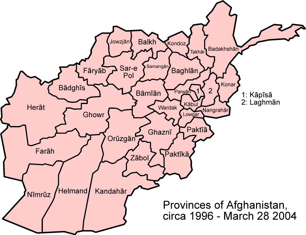
Map of the provinces of Afghanistan as they were between 1996 and March 2004. Based off a 2001 CIA map and Morwen's map of Afghanistan's provinces, I would appreciate if anyone points out any errors.
Made by User:Golbez based off GFDL work by.
[edit] Licensing

File history
Click on a date/time to view the file as it appeared at that time.
| Date/Time | Dimensions | User | Comment | |
|---|---|---|---|---|
| current | 23:41, 12 February 2006 | 1,000×768 (38 KB) | Golbez | (Map of the provinces of Afghanistan as they were between 1996 and March 2004. Based off a 2001 CIA map and Morwen's map of Afghanistan's provinces, I would appreciate if anyone points out any errors. Made by User:Golbez based off GFDL work by [[en:Us) |
File links
The following pages on the English Wikipedia link to this file (pages on other projects are not listed):

