Image:1989 Newcastle earthquake map.png
From Wikipedia, the free encyclopedia
Size of this preview: 704 × 599 pixels
Full resolution (1,500 × 1,277 pixels, file size: 1.07 MB, MIME type: image/png)
| | This is a file from the Wikimedia Commons. The description on its description page there is shown below.
|
[edit] Summary
| Description |
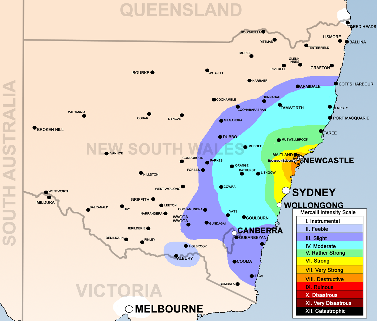
English: 1989 Newcastle earthquake map base on [1], [2], [3], [4] using the Mercalli intensity scale
|
|---|---|
| Source |
Data based on Geoscience Australia [5] and Own work by uploader |
| Date |
1st June 2008 |
| Author | |
| Permission (Reusing this image) |
see below |
[edit] Licensing:
|
File history
Click on a date/time to view the file as it appeared at that time.
| Date/Time | Dimensions | User | Comment | |
|---|---|---|---|---|
| current | 08:49, 1 June 2008 | 1,500×1,277 (1.07 MB) | Bidgee | ({{Information |Description={{en|1=1989 Newcastle earthquake map base on [http://www.ema.gov.au/agd/EMA/emaSchools.nsf/Page/Lesson_Plans_Student_Worksheet_Student_Worksheet_-_Earthquakes], [http://www.ncc.nsw.gov.au/discover_newcastle/local_history/newcast) |
File links
The following pages on the English Wikipedia link to this file (pages on other projects are not listed):

