Image:1927 LA Flood Map.jpg
From Wikipedia, the free encyclopedia
Size of this preview: 271 × 598 pixels
Full resolution (1,200 × 2,650 pixels, file size: 663 KB, MIME type: image/jpeg)
| | This is a file from the Wikimedia Commons. The description on its description page there is shown below.
|
[edit] Summary
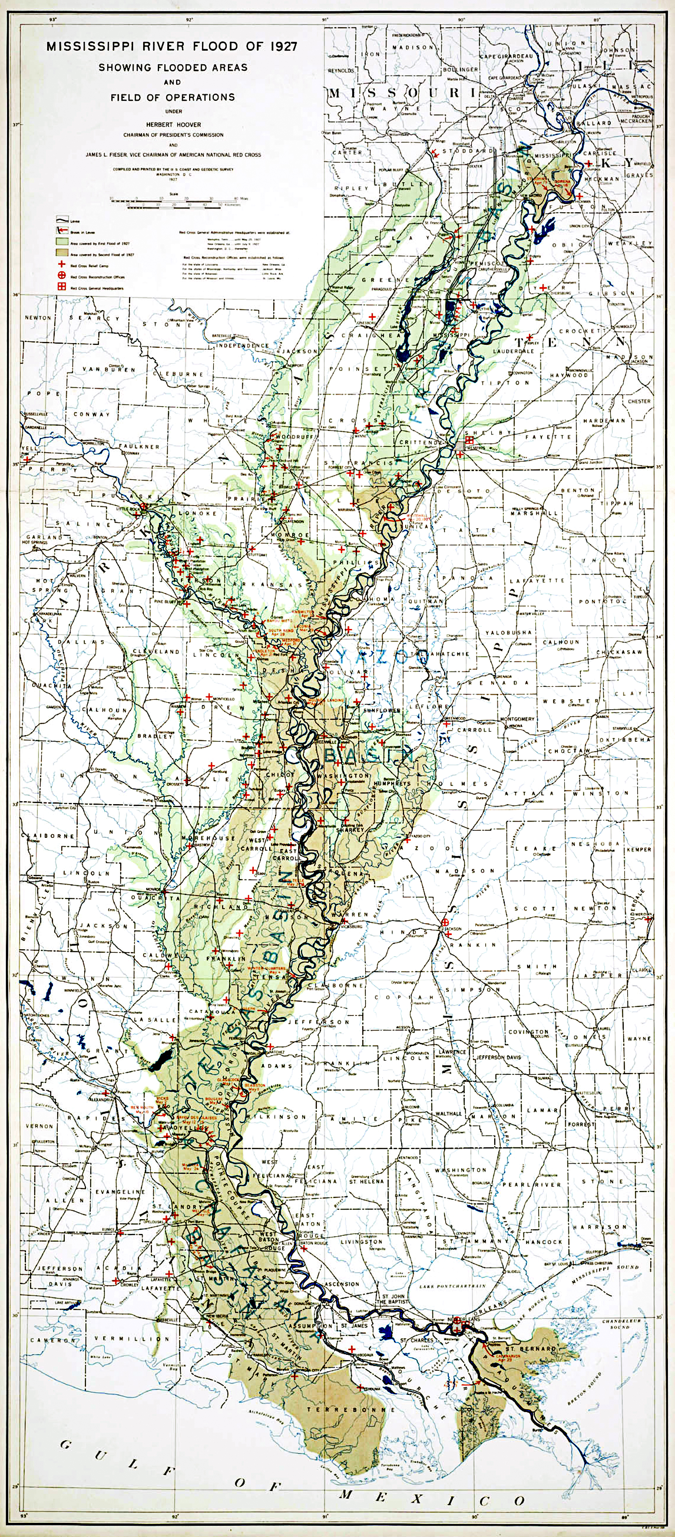
| Description |
MIssissippi River Flood of 1927 Showing Flooded Areas and Field of Operations |
|---|---|
| Source |
Records of the Coast and Geodetic Survey, RG 23 |
| Date |
1927 |
| Author |
Coast and Geodetic Survey |
| Permission (Reusing this image) |
See below |
[edit] Licensing
| This image is in the public domain because it contains materials that originally came from the U.S. National Oceanic and Atmospheric Administration, taken or made during the course of an employee's official duties. |
|
File history
Click on a date/time to view the file as it appeared at that time.
| Date/Time | Dimensions | User | Comment | |
|---|---|---|---|---|
| current | 18:59, 5 May 2008 | 1,200×2,650 (663 KB) | Kkmurray | ({{Information |Description=MIssissippi River Flood of 1927 Showing Flooded Areas and Field of Operations |Source=Records of the Coast and Geodetic Survey, RG 23 http://www.archives.gov/global-pages/larger-image.html?i=/publications/prologue/2007/spring/i) |
File links
The following pages on the English Wikipedia link to this file (pages on other projects are not listed):
Metadata
This file contains additional information, probably added from the digital camera or scanner used to create or digitize it. If the file has been modified from its original state, some details may not fully reflect the modified file.
| Orientation | Normal |
|---|---|
| Horizontal resolution | 200 dpi |
| Vertical resolution | 200 dpi |
| Software used | Adobe Photoshop 7.0 |
| File change date and time | 11:51, 22 March 2007 |
| Color space | 65535 |

