Image:1630 barbarie mercator.jpg
From Wikipedia, the free encyclopedia
Size of this preview: 788 × 600 pixels
Full resolution (2,727 × 2,075 pixels, file size: 2.57 MB, MIME type: image/jpeg)
| | This is a file from the Wikimedia Commons. The description on its description page there is shown below.
|
[edit] Description
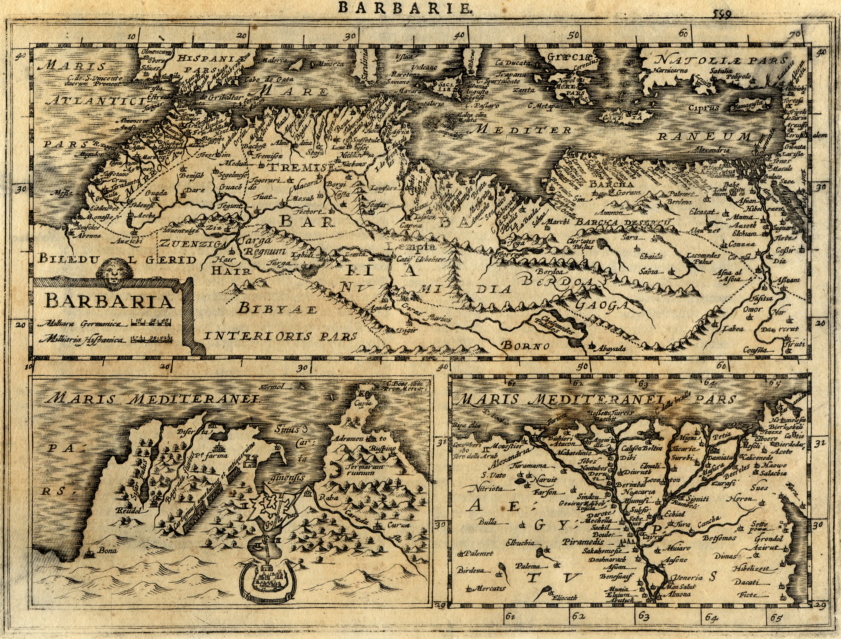
| Description |
Français : Carte géographique ancienne de la Barbarie (Maghreb / Afrique du Nord / Maroc, Algérie, Tunisie, Lybie) dressée par le géographe Gerhard / Gerardus Mercator. Cette carte issue de l'Atlas Minor de Mercator a été gravée en 1630 par Jan Cloppenburgh à Amsterdam.
English: Map of Barbaria (Maghreb / Northern Africa / Morocco, Algeria, Tunisia, Lybia) made by Gerhard / Gerardus Mercator. This map, coming from Atlas Minor of Mercator has been engraved by Jan Cloppenburgh in 1630 in Amsterdam.
|
|---|---|
| Source | |
| Date |
1630 |
| Author |
Gerhard / Gerardus Mercator & Jan Cloppenburgh (reproduit par histoirepostale.net) |
| Permission (Reusing this image) |
see below |
[edit] Licensing
| This file is licensed under the Creative Commons Attribution ShareAlike 3.0 Unported License. In short: you are free to share and make derivative works of the file under the conditions that you appropriately attribute it, and that you distribute it only under a license compatible with this one.
العربية | Català | Česky | Deutsch | Ελληνικά | English | Esperanto | Español | Français | Italiano | עברית | 日本語 | 한국어 | Magyar | Nederlands | Plattdüütsch | Polski | Português | Русский | Svenska | Tiếng Việt | Українська | +/- |
File history
Click on a date/time to view the file as it appeared at that time.
| Date/Time | Dimensions | User | Comment | |
|---|---|---|---|---|
| current | 13:27, 21 April 2008 | 2,727×2,075 (2.57 MB) | Dlebouc | ({{Information |Description= |Source= |Date= |Author= |Permission= |other_versions= }} ) |
| 14:25, 2 January 2008 | 2,727×2,075 (2.57 MB) | Dlebouc | (== Description == {{Information |Description= {{fr|Carte géographique ancienne du Maghreb / Afrique du Nord (Maroc, Algérie, Tunisie, Lybie) dressée par le géographe Gerhard Mercator en 1630. {{en|Map of Maghreb / Northern Africa (Morocco, Algeria, Tu) |
File links
The following pages on the English Wikipedia link to this file (pages on other projects are not listed):
Metadata
This file contains additional information, probably added from the digital camera or scanner used to create or digitize it. If the file has been modified from its original state, some details may not fully reflect the modified file.
| Image title | carte ancienne / old map - Barbarie (Maroc, Algeria, Tunisie, Lybia) - Mercator - 1630 |
|---|---|
| File change date and time | 18:00, 21 April 2008 |
| Author | Mercator |
| Copyright holder | Roland Goutay - Didier Lebouc - www.histoirepostale.net |
| North or South Latitude | North latitude |
| East or West Longitude | East longitude |

