Image:Map of East Prussia 1648.jpg
From Wikipedia, the free encyclopedia
No higher resolution available.
Map_of_East_Prussia_1648.jpg (478 × 554 pixels, file size: 75 KB, MIME type: image/jpeg)
| | This is a file from the Wikimedia Commons. The description on its description page there is shown below.
|
[edit] Summary
| Description |
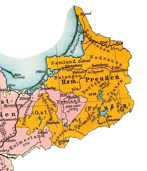
Map of East Prussia 1648 |
|---|---|
| Source |
F. W. Putzgers Historischer Schul-Atlas, 1905 |
| Date |
1905 |
| Author | |
| Permission (Reusing this image) |
PD |
[edit] Licensing
This photographic reproduction is therefore also in the public domain. العربية | Česky | Deutsch | English | Ελληνικά | Español | فارسی | Français | עברית | Bahasa Indonesia | Italiano | 日本語 | 한국어 | Magyar | Nederlands | Polski | Português | Română | Русский | Slovenščina | Српски / Srpski | Basa Sunda | Türkçe | Українська | 中文(繁體) | 中文(简体) | +/- |
File history
Click on a date/time to view the file as it appeared at that time.
| Date/Time | Dimensions | User | Comment | |
|---|---|---|---|---|
| current | 11:22, 21 May 2006 | 478×554 (75 KB) | MatthiasKabel | ({{Information| |Description=Map of East Prussia 1648 |Source=F. W. Putzgers Historischer Schul-Atlas, 1905 |Date=1905 |Permission=PD }}) |

